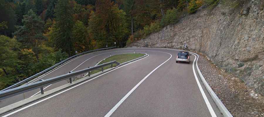
A popular curvy road to the summit of Mendel Pass
Passo Mendola is a mountain pass at an elevation of 1,362m (4,469ft) above sea level, located in Italy. It is a very popular drive for cyclists and bikers.

Where is Mendel Pass?
The pass, also known as Passo della Mendola, is located on the boundary between the provinces of Trentino and South Tyrol, in the northern part of the country. The pass is dominated by tourism, with several restaurants featuring sun decks inviting visitors to take a break. In the 19th and early 20th centuries, the area was a popular health resort, especially for aristocrats and emperors.
Is the road to Mendel Pass paved?
The road to the summit is totally paved. It’s called Strada Statale 42 (SS42) and was built between 1880 and 1885.
How challenging is the road to Mendel Pass?
The road features 17 sharp bends, a 12% maximum gradient, and great panoramic views. The hairpins are wide, and there are a number of wide sweepers to enjoy. However, the instability of the cliffs overhanging the road is a cause for concern. Stabilization work was carried out in 2005, and the pass is under constant observation, particularly in the spring, when thawing and refreezing increase the danger of slides. Due to the nature of the road, trailers are prohibited.
Is the road to Mendel Pass open in winter?
Set high in the Southern Rhaetian Alps, the road is typically open all year round, but short-term closures are common in winter.
How long is the road to Mendel Pass?
The pass is 31km (19 miles) long, running west-east from Cavareno (in Trentino, part of the northern Italian region Trentino-Alto Adige/Südtirol) to Bolzano (in the Autonomous Province of Bolzano, in South Tyrol).
How busy is the road to Mendel Pass?
The drive is very scenic. On weekends and bank holidays, there is a lot of traffic from cars and motorcycles. However, it’s a wide road, and during the week, it is usually much calmer.