Umbrail Pass is an Alpine high mountain road with 35 hairpin turns
Umbrail Pass is an international high mountain pass at an elevation of 2,506m (8,221ft) above sea level, located on the Swiss-Italian border. At this elevation, the road to the summit is currently the highest paved road in Switzerland and one of the highest paved roads in the Alps.
Where is Umbrail Pass?
The pass, known as Giogo di Santa Maria-Passo dell'Umbrail, links the Province of Sondrio in the Lombardy region of northern Italy and the Swiss canton of Graubünden, in the eastern part of the country. The pass is named after the "Piz Umbrail," a nearby mountain peak. There's a simple but beautiful war monument on the right-hand side.
Is Umbrail Pass paved?
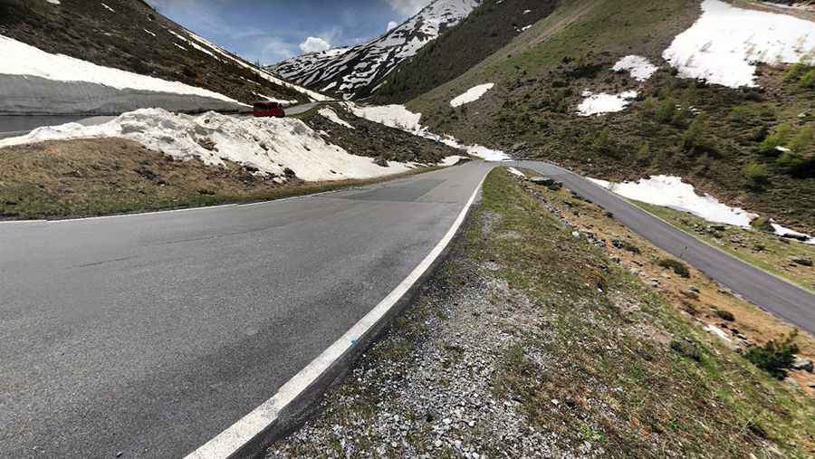
The road through the summit is paved. It was entirely asphalted in 2015. This pass is less known than others in the area and therefore less busy, but it is a fantastic ride and well worth exploring.
Is Umbrail Pass open?
Set high in the Alps, the road is totally closed from October through June. It is closed to vehicles exceeding 18 tons in weight, 2.50m in width, and 10m in length.
Is Umbrail Pass difficult?
The pass has been featured in the Giro d’Italia race. Starting at Sta Maria, the ascent is 13.2 km long. Over this distance, the elevation gain is 1,126 meters. The average percentage is 8.5%, with a maximum slope of 14.0%. The climb is spectacular, and the road features 35 hairpin turns. It’s, at times, quite narrow. The road is unprotected by guardrails and at places really dangerous, with vertical drops of hundreds of meters very close to the asphalt. Take good care, especially if you are descending. The road is impressive. It's an almost one-sided pass. The ride from Santa Maria (north) offers a genuine alpine climb, whereas the southern slope is less than a kilometer long. The hairpins are very narrow and steep, making it hard not to use both sides of the road and overtaking practically impossible. It isn't as bad as it sounds, as it's well-packed, but do take care in the wet. Watch out here for Swiss customs officers; they lurk around here to try and catch smugglers. In summary, it’s moderately difficult, but with some great high-Alpine scenery.
Where does Umbrail Pass start and end?
The road to the summit is 13.2 km (8.20 miles) long, running south-north from the Strada Statale 38 del Passo dello Stelvio to the little village of Santa Maria, near Val Müstair, in the Swiss canton of Graubünden.
Pic: WJS