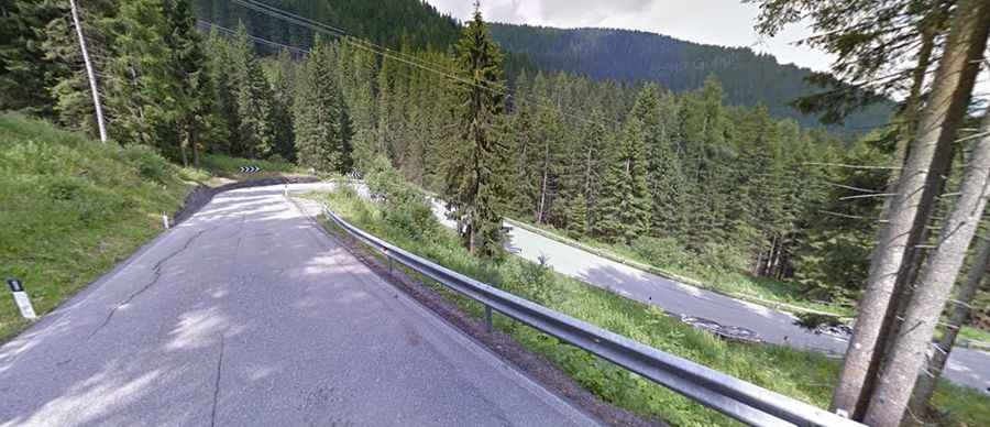
A curvy paved road to San Pellegrino Pass in the Alps
Passo San Pellegrino is a high mountain pass at an elevation of 1,918 m (6,293 ft) above sea level, located on the boundary between the Trentino and Belluno provinces of Italy.
Where is San Pellegrino Pass?
The pass is located in the northern part of the country and links the Trentino-Alto Adige/Südtirol and the Veneto regions.
What’s at the summit of San Pellegrino Pass?
Set high in the Italian Alps, the ski resort Trevalli is located at the pass, one of the most charming mountain passes in Italy, rich in history and ancient traditions. San Pellegrino Pass has some precious jewels: a ring of bright water reflecting the beauties of nature; a historic hospice, a point of reference for pilgrims reaching the Agordino Valley; and the church dedicated to St. Antonio of Padua, decorated with paintings by artist G.B. Chiocchetti from Moena.
Is San Pellegrino Pass paved?
The road through the pass is fully paved. It’s called Strada Statale 346 del Passo di S. Pellegrino (SS346).
How long is San Pellegrino Pass?
The pass is 29 km (18 miles) long, running west-east from Moena (in Trentino, in the region Trentino-Alto Adige/Südtirol) to Cencenighe Agordino (in the Province of Belluno, in the Veneto region).
How steep is San Pellegrino Pass?
The pass has been climbed by the Giro d’Italia bicycle race. Starting from Cencenighe, the ascent is 18.2 km long. Over this distance, the elevation gain is 1,144 meters, with an average gradient of 6.3%. Starting from Moena, the ascent is 11.41 km long. Over this distance, the elevation gain is 778 meters, with an average gradient of 6.8%.