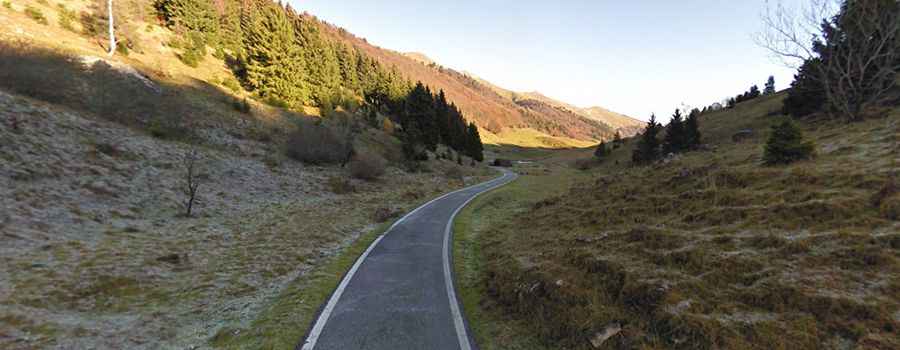
Driving the curvy and narrow road to Cason di Lanza Pass in the Alps
Passo del Cason di Lanza is a high mountain pass at an elevation of 1.552m (5,091ft) above the sea level, located in Udine, a province in the autonomous Friuli-Venezia Giulia region of Italy, bordering Austria. The final 6km hit gradients of up to 16%.

Passo del Cason di Lanza is a high mountain pass at an elevation of 1.552m (5,091ft) above sea level, located in Udine, in Italy. The final 6km hit gradients of up to 16%.
Where is Cason di Lanza Pass?
The pass, also known as Pas di Lance and Lanzenpass, is located in the autonomous Friuli-Venezia Giulia region, in the northeastern part of the country, near the Austrian border.
How long is Cason di Lanza Pass?
The road to the summit is fully paved. It’s 30km (18.64 miles) long, running from Paularo to Pontebba. Snow can be found until June.
How steep is Cason di Lanza Pass?
The pass has been climbed several times by the Giro d’Italia bicycle race. There are 2 routes to reach the summit. Starting from Pontebba, the ascent is 15.6 km long. Over this distance, the elevation gain is 991 meters. The average percentage is 6.4 %. And starting from Paularo, the ascent is 15.4 km long. Over this distance, the elevation gain is 912 meters. The average percentage is 5.9 %. The final 6km hit gradients of up to 16%.
How challenging is Cason di Lanza Pass?
The curvy road to the pass is very narrow. Oncoming traffic is always problematic and scary. In some parts the road is in terrible condition. The narrow, partly blind road winds around rock faces. The road is in very poor condition in places. Rain gutters with loose covers, potholes, rockfalls and gravel on the road. In places the tarmac is washed away and you’ll have to drive over a short gravel track. However, these places are marked with warning signs.