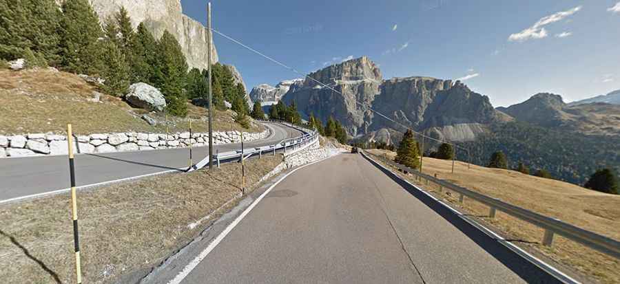
Sella Pass is one of the most iconic roads of the Dolomites
Passo Sella is a high mountain pass at an elevation of 2.246m (7,368ft) above sea level, located in Italy. The views around you are terrific.
Where is Sella Pass?
The pass is located on the boundary between Trento and Bolzano provinces, in the northern part of the country. It links Val Gardena in South Tyrol and Canazei in the Fascia Valley in Trentino.
When was the road to Sella Pass built?
The road to the summit was opened on the 26th of October 1856, and its construction dates back to 1843.
Is the road to Sella Pass paved?
Set high in the Italian Dolomites, the winding road to the summit, also known as Sellajoch, is fully paved and features sharp hairpin bends and steep drops. It’s called Strada Statale 242 (SS242).
How long is Sella Pass?
The pass is 17.4km (10.81 miles) long, running from Canazei to Plan De Gralba.
Is Sella Pass steep?
The pass has been featured in the Giro d’Italia and has been the Cima Coppi (or highest point of the race). It’s one of the most famous passes in the Dolomites. The road is pretty steep, hitting a 12.5% maximum gradient through some of the ramps.
Is Sella Pass open?
Access to the pass is typically open all year round, but short-term closures are common in winter due to dangerous weather conditions.
Is Sella Pass worth it?
This pass is crowned by the wonderful Torri del Sella and Mesules. You can enjoy a really stunning view of the Sassolungo group (3,181 meters). The views are breathtaking, and each small village you go through is charming and lovely. There’s a hotel and some opportunities for refreshments at the summit. It’s usually very crowded in holiday seasons, so it's better to avoid the first three weeks of August. Huge coaches sneak constantly across the pass summit and spit out endless streams of tourists that disappear after a few minutes when they have taken hundreds of pictures and jammed the souvenir shop.