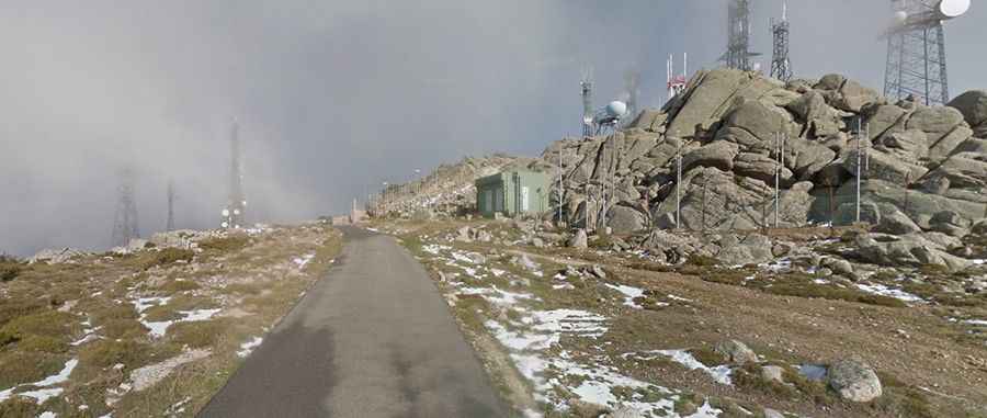
An awe-inspiring road to Punta Sa Berritta in Sardinia
Punta Sa Berritta is a mountain peak at an elevation of 1,362m (4,469ft) above sea level, located in the Gallura region of Sardinia, in Italy.

Where is Punta Sa Berritta?
The peak, also known as Punta Balestreri, is located in the province of Sassari, in the northeastern part of Sardinia.
What’s at the Summit of Punta Sa Berritta?
At the summit, there is a military complex for the Italian Air Force, a heliport for the Servizio Antincendi, and a large array of TV towers. Although not extremely high at just over 1,300m, the peak—also known as Mount Limbara—appears imposing and evocative. It features rocky summits shaped by millennia of weathering, giving them strange and eccentric forms. This peak dominates the Costa Smeralda and is a popular destination for cyclists from all over Europe.
Is the Road to Punta Sa Berritta Paved?
The road to the summit is called Strada Provinciale 51 (SP51). It is paved but in poor condition, often very narrow, and lacking central lines. The road is bumpy with numerous hairpin turns, and there are some nasty bumps along the way that are difficult to see and even harder to avoid.
How Long is the Road to Punta Sa Berritta?
Starting from Strada Statale 392, the ascent is 10.6 km (6.58 miles) long, with an elevation gain of 775 meters. The average gradient is 7.31%.
Is the Road to Punta Sa Berritta Dangerous in Winter?
Set high in the Mount Limbara massif, chains or snow tires may be required during the winter months. While the weather can be worse in winter, there typically isn't much snowfall.