The Wild Road to Selleries Refuge
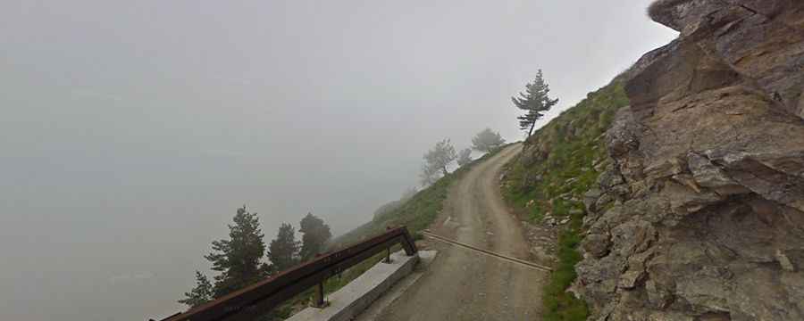
Rifugio Selleries is a high mountain refuge at an elevation of 2,023m (6,637ft) above sea level, located in the Metropolitan City of Turin, Italy. The road to reach the summit starts paved, but the last 5 km are on a dirt track.
Where is Selleries Refuge?
The refuge is located in the Piedmont region, in the northwestern part of the country, not far from the French border.
When was Selleries Refuge inaugurated?
The mountain refuge, inaugurated in 2006, sits within the Parco Naturale Orsiera Rocciavrè, a park that includes the alpine area of Orsiera Rocciavrè, lying between the Susa, Chisone, and Sangone valleys, and the xeric areas around Orridi di Chianocco and Foresto (ravines) in Susa Valley. The refuge is open year-round.
How long is the road to Selleries Refuge?
Starting from Strada Provinciale 23 del Colle di Sestriere, south of Fenestrelle, the road to the refuge is 12.9km (8.01 miles) long.
Is the road to Selleries Refuge unpaved?
The road includes both paved and unpaved sections. It is fully asphalted at the beginning, with a series of wide bends on a steady ascent, leading to the Agnelli Sanatorium. After a couple more bends, the road levels out. At the turnoff for Forte, continue to the crossroads for Selleries Refuge. Here, take a right turn and follow the mostly unpaved road to the refuge. The ascent, particularly in the middle section, should not be underestimated.