Driving to Monte Giogo: Abandoned NATO Antennas and Cold War Relics in the Tuscan Mountains
Monte Giogo is a high mountain peak at an elevation of 1,510m (4,954ft) above sea level, located in the province of Massa-Carrara in the Tuscany region of Italy.

Why is Monte Giogo famous?
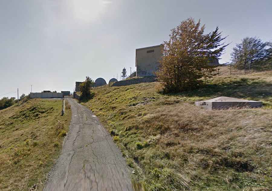
The summit hosts a radio station of NATO, abandoned in the 70s, used during the Cold War. The antennas belong to the former NATO troposcatter communications network, known as ACE High (Allied Command Europe Highband). Surrounded by unattended, half-destroyed buildings, you’ll feel like you're in a zombie apocalypse scene.
When was the road to Monte Giogo built?
Set high in the Tuscan-Emilian Apennines, the road to the summit was built in 1964/1965 to construct the NATO radio station.
Is the road to Monte Giogo paved?
The road to the summit is entirely paved but quite damaged. An SUV or high-clearance vehicle is recommended.
How long is the road to Monte Giogo?
Starting at the paved Strada Provinciale 25, the road to the summit is 3.2 km (1.98 miles) long and features 4 hairpin turns. The drive is steep. Over this distance, the elevation gain is 212 m, and the average gradient is 6.62%.