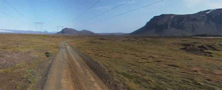
Driving Iceland's F338 Road (Skjaldbreiðarvegur): A Journey Along Powerlines
F338, also known as Skjaldbreiðarvegur, is a very scenic road situated in the Southern Region of Iceland. It is not recommended for newbies. You’ll need a 4x4 vehicle with high clearance. Along the way, drivers will have to cross two rivers. It’s one of the famous F Roads of the country.

How long is F338 Road (Skjaldbreiðarvegur)?
The road is 51 km (32 miles) long, running west-east from 550 Road (near Brunnavatn) to F35 Road, 5 km to the north of Gullfoss. The road is unpaved, with boulders, ruts, and potholes. Expect a diverse range of surfaces, from stony terrain to sandy soil and even stretches of black sand. This is not a road for those who fear heights or drive small passenger cars.
Is F338 Road (Skjaldbreiðarvegur) open year-round?
Set high in Iceland's highlands, the road is open only during the summer months, usually between late June and early September.
How remote is the F338 Road (Skjaldbreiðarvegur)?
The road follows power lines. Traveling alone is not recommended due to its remote location, with minimal passing traffic and sporadic cell phone coverage. Breakdowns can be challenging.
Is the F338 Road (Skjaldbreiðarvegur) worth the drive?
The road is very scenic, running through Iceland's landscapes with stunning views of volcanoes and lava fields. However, be prepared for the challenging conditions.
Are there rivers to cross on the F338 Road (Skjaldbreiðarvegur)?
While driving the road, you’ll have to cross two significant rivers. It's crucial to exercise caution, especially during heavy rainfall or warm weather when water levels can rise abruptly. Attempting these crossings with a small car is strongly discouraged. In case of difficulty or getting stuck, dial 112 for assistance. Always check the river's depth before proceeding, as conditions can change rapidly. Remember, rental car insurance typically does not cover water-related damages, including river crossings.