A 5-star road to Mount Tymfristos in the Pindus mountains
Mount Tymfristos is a high mountain peak at an elevation of 1.862m (6,108ft) above sea level, located in the heart of Central Greece.
Where is Mount Tymfristos?
The mountain, also known as Mount Velouchi, is located between the prefectures of Eurytania and Phthiotis.
What’s at the summit of Mount Tymfristos?
The pass belongs to the Pindus mountain range. At the summit, there’s a populated ski resort inaugurated in 1974, where several ski lifts and a number of beginner slopes, as well as advanced skier slopes, exist.
How long is the road to Mount Tymfristos?
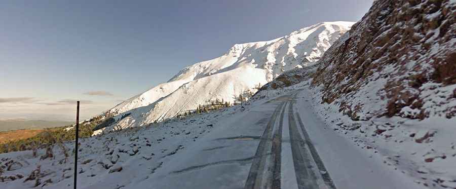
The road to the summit is fully paved but pretty steep. Starting from Karpenisi (a town in the regional unit of Evrytania at 981m above sea level), the ascent is 10.2km long with 9 hairpin turns. Over this distance, the elevation gain is 881 meters. The average gradient is 8.63%.
How to reach the real summit of Mount Tymfristos?
A gravel road located west of the pass climbs up to 2.192m (7,191ft) above sea level to the true summit. It’s a chairlift access road for 4x4 vehicles only. It is impassable from November to June. From the summit, you can see the mountains of central Greece, with Vardousia and Kaliakouda to the south and Panetoliko and Chelidona to the southwest. It’s one of the highest roads in the country.