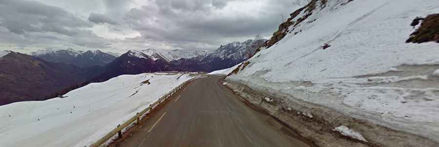
Superbagneres: the road continually snakes its way up ahead
Superbagnères is a ski station at an elevation of 1.804m (5,918ft) above sea level, located in the department of Haute-Garonne, in France.
Where is Superbagnères?
The station is located in the Midi-Pyrénées region, in the southern part of the country.
Is the road to Superbagnères paved?
The road to the summit is called D46. It’s fully paved with several short stretches in excess of 12.5%. The road surface is in very good condition throughout.
How long is the road to Superbagnères?
Starting from Bagnères de Luchon, the ascent is 18.5km (11.49 miles) long. Over this distance, the elevation gain is 1.170 meters. The average percentage is 6.3 %. The climb has been included in several Tour de France mountain top finishes. Unfortunately due to a weight limitation on a key bridge heading towards Superbagneres the Tour can for the moment no longer include Superbagneres in its Tour route.
Is the road to Superbagnères worth the drive?
Set high in the heart of the Pyrenees, and completely surrounded by high mountains, the route winds around a massif giving ever changing views. At the top are 360 degrees panoramic views. Surrounded by no less than fifteen snowcapped peaks above 3,000 metres, the panoramic views are truly breathtaking on a clear day as the road continually snakes its way up ahead.