An awe-inspiring drive to Belvedere du Viso in the Cottian Alps
Belvédère du Cirque du Mont-Viso is a natural viewpoint at an elevation of 2.147m (7,043ft) above sea level, located in the Hautes-Alpes department of France.
Where is Belvédère du Cirque du Mont-Viso?
Belvedere du Viso is located in the Provence-Alpes-Côte d'Azur region, in the southeastern part of the country, near the Italian border, within the Queyras Regional Natural Park.
When was the road Belvédère du Cirque du Mont-Viso built?
The Route du Viso was created to serve the Haut Guil valley and create a tourist attraction there by creating a car park with an exceptional viewpoint over the north face of Mont Viso called "Grand Belvédère du Viso". The Route was started in 1864 by the inhabitants of Ristolas, then improved and extended with the help of the Ministry of Agriculture, the Army (Alpine Hunter Battalions), the Touring Club of France, the Queyras Tourist Office and the CAF, and of course Michelin, with an inauguration in 1931.
Is the road to Belvédère du Cirque du Mont-Viso open in winter?
Set high in the Cottian Alps, in the heart of the Ristolas Mont-Viso National Nature Reserve, the road is usually impassable in winters due to the snowfall.
Is the road to Belvédère du Cirque du Mont-Viso paved?
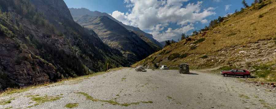
The road to the summit is mostly paved with damaged sections and gravel parts. This road is really nice for mountain biking, a nice climb that really breaks your legs, alternating between bends, false flat, flat for resting, and a single descent. There’s a small parking lot at the summit.
How long is the road to Belvédère du Cirque du Mont-Viso?
The drive is pretty steep, hitting an 11.5% of maximum gradient through some of the ramps. Starting from Aiguilles, the ascent is 19.3km (12 miles) long. Over this distance, the elevation gain is 676 meters. The average percentage is 3.5 %.
Pic: Aurélien Pavel