Water, snow and fog at the top of Mont-Aigoual
Mont-Aigoual is a high mountain pass at an elevation of 1.567m (5,141ft) above the sea level, located on the border of the Lozère and Gard departments in southern France. At the peak you have unlimited views and the highest manned weather station in France.
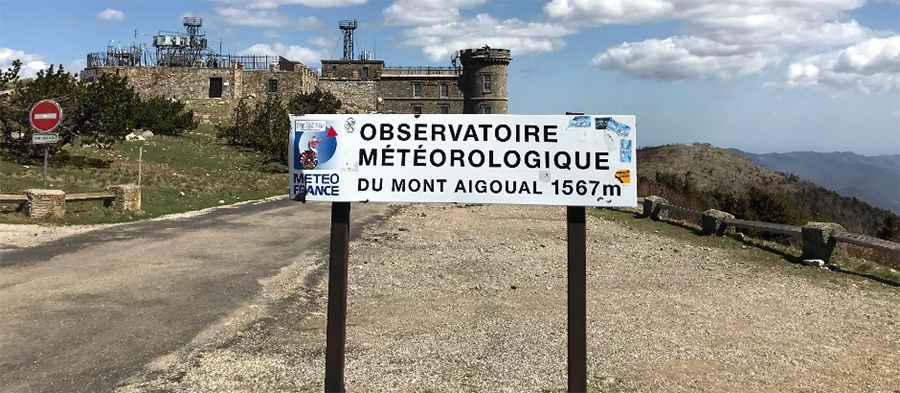
The pass is part of the Massif Central, and it is located within the Cévennes National Park. The road to the summit is called D118. It’s asphalted but features steep sections (up to 10.0%). At the summit there’s an observatory known as the Mount Aigoual Observatory and the Météo France observatory. Do not travel this pass in severe weather conditions. Extremely hard to reach in winter, where an aerial struggle is fought between ocean and Mediterranean airstreams, often at 28 degrees below zero (Celsius!), and winds measured at over 300 km/h, not to mention wild rain (over 2 metres per year – don’t forget that the word Aigoual refers to water, snow and fog…)
The pass has been featured in the Tour de France race. There are several routes to reach the summit. Starting from Meyrueis, the ascent is 26 km long. Over this distance, the elevation gain is 862 meters. The average percentage is 3.3 %. Starting from Rousses, the ascent is 16.6 km long. Over this distance, the elevation gain is 835 meters. The average percentage is 5 %. Starting from Le Vigan, the ascent is 37.3 km long. Over this distance, the elevation gain is 1.336 meters. The average percentage is 3.6 %. And starting from Valleraugue, the ascent is 28.5 km long. Over this distance, the elevation gain is 1.225 meters. The average percentage is 4.3 %. The drive is definitely worth it. There are many excellent photo opportunities. Don’t forget your camera! From this point, visitors can enjoy a view over a quarter of France, from Mont Ventoux to Mont Blanc, from Canigou in the Pic du Midi, to the Puy mountains, to the Mediterranean sea...
Pic: A Ghanna