A curvy paved road to Col de Perty
Col de Perty is a mountain pass at an elevation of 1.302m (4,271ft) above the sea level, located in the Drôme department in the Auvergne-Rhône-Alpes region in southeastern France.
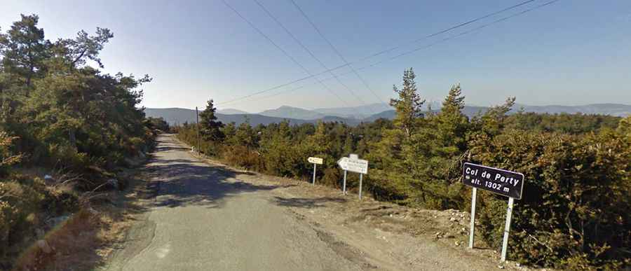
The winding road to the summit is totally paved but narrow. It’s called D65. It is very steep, hitting a 12% of maximum gradient through some of the ramps. The pass road is 19.8km long, running west-east from Montauban-sur-l'Ouvèze to Laborel.
Starting from La Combe, the ascent is 12.5 km long. Over this distance, the elevation gain is 600 meters. The average percentage is 4.8 %. And starting from Laborel, the ascent is 8.5 km long. Over this distance, the elevation gain is 475 meters. The average percentage is 5.6 %.