Col de la Bataille
Col de la Bataille is a mountain pass at an elevation of 1.313m (4,307ft) above the sea level, located in the Drôme department in southeastern France.
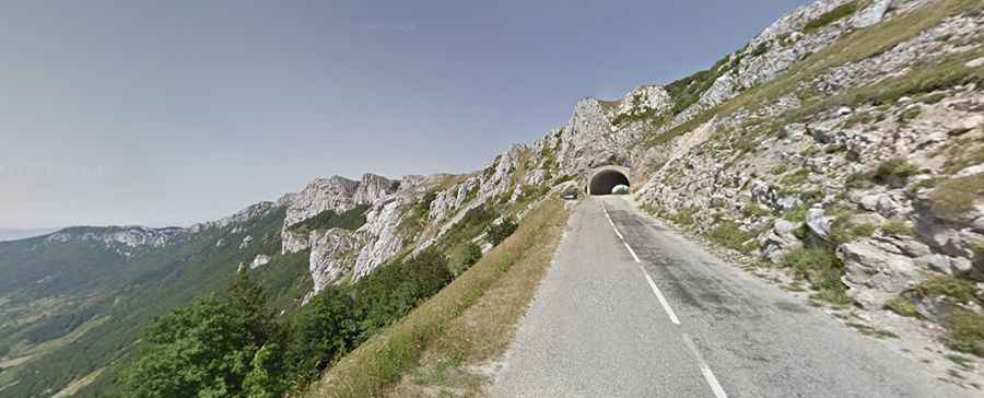
The road to the summit is asphalted. It’s called D199. It’s steep and includes several hairpin bends. The highest point of the route is located near the pass, in the Tunnel du Col de la Bataille, at 1.336m above the sea level.
There are several routes to reach the summit. Starting from Saint Jean en Royans, the ascent is 30.3 km long. Over this distance, the elevation gain is 1.063 meters. The average percentage is 3.5 %. Starting from Oriol en Royans, the ascent is 23.7 km long. Over this distance, the elevation gain is 1.028 meters. The average percentage is 4.3 %. Starting from Leoncel, the ascent is 8.3 km long. Over this distance, the elevation gain is 400 meters. The average percentage is 4.8 %. And starting from Les Trois Routes, the ascent is 16.6 km long. Over this distance, the elevation gain is 203 meters. The average percentage is 1.2 %.