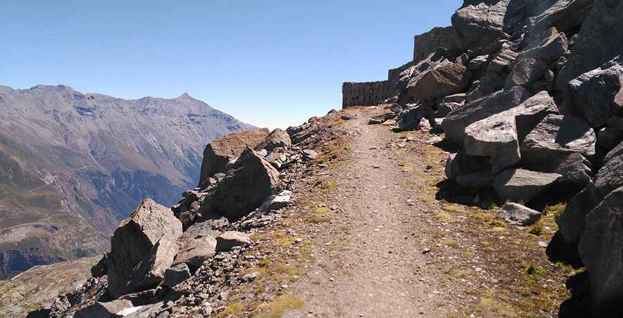
An Old Military Road to the Summit of Mont Malamot in the Cottian Alps
Mont Malamot is a high mountain peak at an elevation of 2,885 m (9,465 ft) above sea level, located in the Savoie department of France. The road to the summit is permanently closed to motorized vehicles. It's one of the highest roads in Europe.

Where is Mont Malamot?
The peak is located in the Auvergne-Rhône-Alpes region in the southeastern part of the country.
What is at the Summit of Mont Malamot?
At the summit, there is a military fortress called Fort Malamot. Built by the Italian Regio Esercito in 1889, the fortress has two floors and could house around 200 troops. The area was further fortified from 1932 to 1940 during the construction of the Alpine Wall.
Is the Road to Mont Malamot Unpaved?
The road to the summit is completely unpaved. It’s called Strada militare Bivio Varisello-Giaset-Malamot, and it is an old military road. After a few kilometers, the road is closed by a wooden barrier. Beyond this point, the road is still in good condition for passage, with stone walls, retaining walls still standing, and adequate drainage for rainwater. However, the middle section is in very bad condition and is almost impassable for cyclists, largely due to collapse from rainwater and winter frost. The road to the summit is extreme: it is narrow, steep, and full of stones, with gradients exceeding 20%.
How Long is the Road to Mont Malamot?
Starting from the paved D1006 Road, south of Col du Mont-Cenis, the road to the summit is 10.9 km (6.77 miles) long. Over this distance, the elevation gain is 1,018 m, and the average gradient is 9.33%.
Is the Road to Mont Malamot Open in Winter?
Set high in the northern Cottian Alps, the road is completely impassable from September to June. It's one of the highest roads in the country.
Pic: https://ruteandoproac.blogspot.com.es/2017/09/verano-2017-alpes-franceses-dolomitas.html