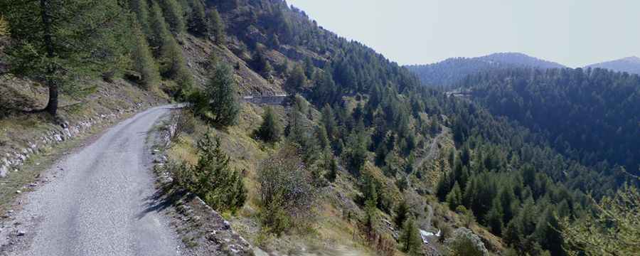
Travelling through the scenic Route de l'Authion in the Alpes-Maritimes
Route de l'Authion is a very scenic drive located in the Alpes-Maritimes department of France. Along the road, there are several forts and military ruins. The drive is highly rewarding for its scenery—provided you watch carefully where you place your wheels!
Where is Route de l'Authion?
The road, officially known as D68, is located in the Provence-Alpes-Côte d'Azur region, in the southeastern part of the country.
Why is Route de l'Authion famous?
It’s an old military road that connects forts built between the late 19th century and World War II. The strategic location of the Authion Massif commemorates the military history of the Maritime Alps valleys, from the Napoleonic wars to World War II. The area was the scene of bloody fighting, including battles related to the Maginot Line defenses during World War II.
Is Route de l'Authion open in winter?
Set high in the Mercantour National Park, it’s a high mountain road. The route is closed from November 30 to April 30. It starts at Col de Turini, at 1,610m (5,282ft) above sea level, and climbs to Silver Camp at 1,737m, Tueis at 1,889m, and a small pass at 1,986m, before joining the Authion Massif at 2,080m above sea level.
How long is Route de l'Authion?
The loop road is 12.8 km (7.95 miles) long and starts at Col de Turini.
Is Route de l'Authion paved?
The road is fully paved but has some potholes along the way. It’s not in the best shape anymore and lacks guardrails. Not recommended for lowered cars. The road is narrow but one-way, making the drive pretty scary.
Is Route de l'Authion worth the drive?
The drive, also known as Circuit de l'Authion, is definitely worth it. Along the road, it’s possible to discover several military monuments, though most are in ruins. The breathtaking panorama offers views of the eastern part of the Mercantour Massif and the final foothills of the Alps plunging into the Mediterranean Sea. The views of the peaks of the Mercantour National Park are definitely worth the detour.