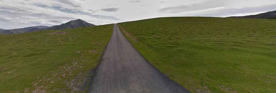
The road to Col d'Orgambide is not for the faint of heart
Col d'Orgambide is an international mountain pass at an elevation of 992m (3,254ft) above sea level, located on the Spanish-French border.
Where is Col d'Orgambide?
The pass, also known as Collado de Orgambide, links the Pyrénées-Atlantiques department in the Nouvelle-Aquitaine Region of southeastern France and the province and autonomous community of Navarre, in the northern part of Spain. The French/Spanish border is situated at the summit.
How Long is Col d'Orgambide?
The road is 11.2 km (6.95 miles) long, running south-north from Orbaizeta (a Spanish town) to the D428 road (in France).
Is Col d'Orgambide Paved?
Set high in the Pyrenees, the lonely road to the summit is totally paved with a few concrete sections. The road includes very steep parts. It is very narrow—impassable for two cars at the same time—and the views at the summit are spectacular.