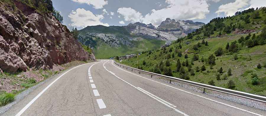
Driving the paved road to Somport Pass in the Pyrenees
Puerto de Somport-Col du Somport is an international high mountain pass at an elevation of 1.637m (5,370ft) above sea level, on the border of France and Spain.
Where is Somport Pass?
Set high in the Pyrenees mountain range, the pass links the province of Huesca, in northeastern Spain and the Pyrénées-Atlantiques department in south-western France. It is located between the valley of the Aragón river, on the Spanish side, and the valley of the Aspe river, on the French side.
Why is it called Somport Pass?
The border is situated at the summit. Its name comes from the Latin ''summus portus'', which means the highest port. It is the main pass in the central Pyrenees.
How long is Somport Pass?
The road to the summit, also known as Port of Aspe or Port of Canfranc, is totally paved. It’s called N330a. The pass is 16.2 km (10.06 miles) long, running south-north from Canfranc-Estación in Huesca to Les Forges d'Abel in France. It has been featured in the Tour de France and Vuelta a España races. It’s a steep climb, hitting a 10% through some of the ramps.
Is Somport Pass open?
The road is accessible all year round, except in adverse weather conditions. The pass was bypassed by a tunnel, known as Túnel de Somport, open throughout the year. The 8.6 kilometres (5.3 mi) long tunnel was opened on 7 February 2003.