Travel Guide to the Cirque de Gavarnie
Cirque de Gavarnie is a large rock amphitheater at an elevation of 1,690m (5,544ft) above sea level, located in the Hautes-Pyrénées department of France.
Cirque de Gavarnie is a large rock amphitheater at an elevation of 1,690m (5,544ft) above sea level, located in the Hautes-Pyrénées department of France.
Where is Cirque de Gavarnie?
The cirque is located east of Port de Boucharo-Puerto de Bujaruelo, in the Occitania region, in the southwestern part of the country, near the Spanish border. The Gavarnie Cirque is the best known of the cirques in the region, with its 6.5 km (4 miles) diameter, its 1,500-meter (4,921 ft) high walls, and, at its heart, the largest waterfall in Europe (427m / 1,401ft). The road follows incredible natural bowls carved out by ancient glaciers in grey, ochre, and pink limestone rocks. This is the only cirque accessible all year round.
Can I Drive to Cirque de Gavarnie?
The French side of Cirque de Gavarnie is part of the Pyrenees National Park, while the Spanish side belongs to the National Park of Ordesa and Monte Perdido. This means there are strict regulations to protect the rich flora and fauna. The road is completely closed to private vehicles.
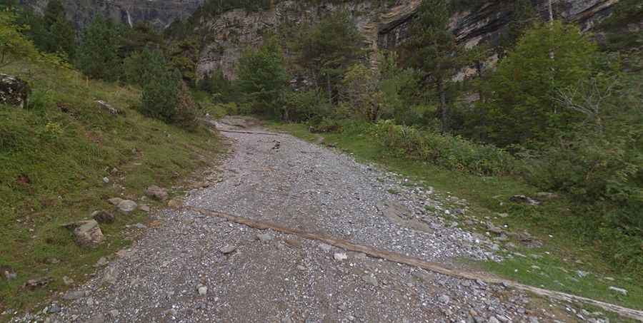
How Long is the Road to Cirque de Gavarnie?
Set high in the Pyrenees, the narrow road to the cirque is completely unpaved and very rocky. It ends at a mountain hotel, known as Hôtel du Cirque, built in 1845. Starting from Gavarnie, the steep and curvy road to the hotel is 3.9 km (2.42 miles) long. 4x4 vehicles with high clearance only.