An Iconic Road to Col du Joly in the French Alps
Col du Joly is a high mountain pass at an elevation of 1,989m (6,525ft) above sea level, located in the Rhône-Alpes region of France.
Where is Col du Joly?
The pass is located on the boundary between Haute-Savoie and Savoie departments, in the southeastern part of the country. At the summit, there’s a restaurant known as Chez Gaston Col du Joly Hauteluce.
Is Col du Joly Paved?
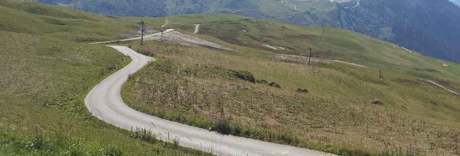
The road to the summit is mostly paved on the southern side and unpaved but in good condition on the northern side. It runs south-north from Beaufort (also known as Beaufort-sur-Doron) to Les Contamines-Montjoie. The road is narrow in parts, and there is some traffic up to the restaurant at the top, where many people begin walks on the Tour du Mont Blanc.
Is the Road to Col du Joly Worth the Drive?
The road to the summit is steep, with a maximum gradient of 10.9% through some of the ramps. At the summit, you can enjoy one of the closest and most beautiful views of Mont Blanc.
Pic: Claire Douet