Col du Noyer is an iconic Tour de France climb
Col du Noyer is a high mountain pass with an elevation of 1,664m (5,459ft) above sea level, located in the Hautes-Alpes department of France.
Where is Col du Noyer?
The pass is situated in the Provence-Alpes-Côte d'Azur region, in the southeastern part of the country. At the summit, there is a mountain refuge, which was inaugurated in 1858.
Is Col du Noyer Paved?
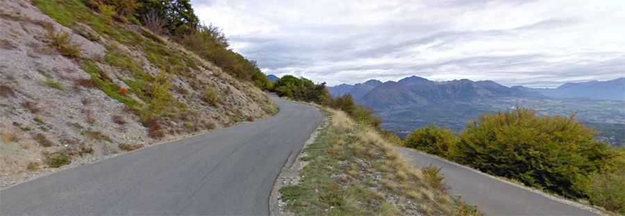
The road to the summit is fully paved and is known as D17T. It was constructed in 1850 from an old mule path, which was once one of the most frequently used routes into Le Dévoluy. The pass offers stunning panoramic views, with the arid ridges of Le Dévoluy on one side and the lush Drac Valley on the other.
Is Col du Noyer Open in Winter?
Located high in the Alps, the road is completely closed during the winter season.
How Long is Col du Noyer?
The pass is 14.9 km (9.25 miles) long, running from Le Dévoluy to Le Noyer in a west-east direction. The road is very curvy, with numerous hairpin turns. It is narrow, remote, and has been featured as a climb in the Tour de France.