Pas de Peyrol is the highest road pass in the Massif Central
Pas de Peyrol is a high mountain pass at an elevation of 1,589m (5,213ft) above sea level, located in the Cantal department of France.
Where is Pas de Peyrol?
The pass is located in the Auvergne-Rhône-Alpes region, in the south-central part of France. At the summit, there’s a big parking lot and a bar-restaurant called Chalet de Puy Mary.
Is the road to Pas de Peyrol paved?
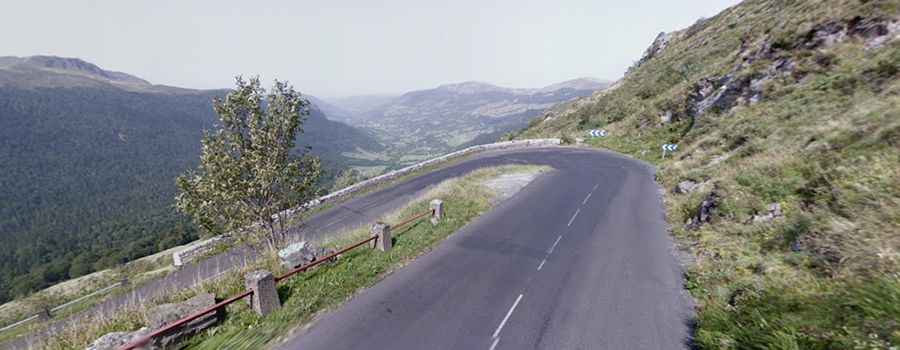
Set high in the Massif Central, the road to the summit, also known as Puy Mary, is fully paved. It’s called D680. At this elevation, it’s said to be the highest road pass in the Massif Central.
How long is Pas de Peyrol?
The pass is 33.4km (20.75 miles) long, running west-east from Salers to Murat. On the southern side, a road starting from Mandailles-Saint-Julien and known as D17 also leads to the summit.
How challenging is the road to Pas de Peyrol?
The road is curvy and narrow, closed to buses and trucks. It’s pretty steep in parts, hitting a 14.0% maximum gradient through some of the ramps. The pass has been climbed by the Tour de France bicycle race.