Col de Joux Plane is one of the six major passes of the French Alps
Col de Joux Plane is a high mountain pass at an elevation of 1,697m (5,567ft) above sea level, located in the Haute-Savoie department of France. For cyclists, it’s renowned as one of the six major passes of the French massif, alongside the Galibier, Izoard, L’Alpe d’Huez, Mont Ventoux, and the Tourmalet.
Where is Col de Joux Plane?
The pass is located in the Auvergne-Rhône-Alpes region, in the southeastern part of the country, near the Swiss border, at the southern end of the Chablais.
What’s at the summit of Col de Joux Plane?
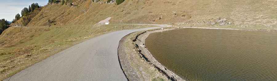
The summit hosts a bar called Le Relais des Vallées and a parking lot. A gravel road north of the pass climbs up to the true summit at 1,714m (5,623ft) above sea level. The views over Mont-Blanc are absolutely majestic.
Is the road to Col de Joux Plane paved?
The road to the summit is completely paved. It’s called D354. It’s a narrow, often single-lane road, and quite steep, with some ramps reaching a grueling 15.0% gradient. To climb the route on a sunny day in mid-summer, it’s important to start early, as the entire slope faces south, making the climb potentially exhausting in the heat.
How long is the road through Col de Joux Plane?
The steep and sinuous pass is 23.7 km (14.72 miles) long, linking the town of Morzine to the north with Samoëns to the south. Starting from Morzine, the ascent is 10.9 km long, with an elevation gain of 711 meters. The average gradient is 6.5%. Starting from Samoëns, the ascent is 11.6 km long, with an elevation gain of 989 meters, and the average gradient is 8.5%.
How challenging is the climb up Col de Joux Plane?
Known as one of the tougher climbs on the Tour de France, this is a difficult climb with no respite. It’s a tough climb from either side, but from Samoëns, it’s probably the toughest climb in Haute-Savoie. While not the longest climb, it is very steep and irregular. It may not be as famous as some of its 'cousins' to the south, like Alpe d’Huez or the Galibier, but it is undeniably one of the toughest climbs in the Northern Alps.