An epic road to Col d'Azet in the Pyrenees
Col d'Azet is a high mountain pass at an elevation of 1.580m (5,183ft) above the sea level, located in the Hautes-Pyrénées department in south-western France.
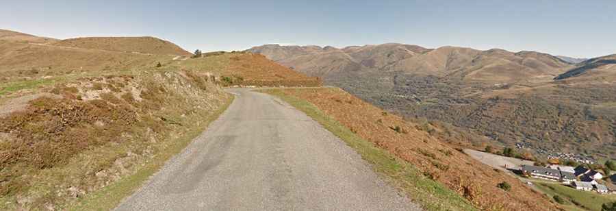
Tucked away in the Pyrenees, a range of mountains in southwest Europe that forms a natural border between France and Spain, the pass, also called col de Val-Louron-Azet, has been climbed by the Tour of France bicycle race. The road is paved, pretty narrow and unprotected by guardrails. It’s a scenic climb and excellent views from the summit. Hang-gliders frequent the skies. Both sides are rather steep in the lower kilometres and ease a little nearer the summit. Very steep section through village of Azet. No facilities at the summit. The road is 18.2 km (11.30 miles) long, running west-east from Saint-Lary-Soulan to Génos.
There are 3 routes to reach the summit. Starting from Génos, the ascent is 7.47 km long. Over this distance, the elevation gain is 620 meters. The average percentage is 8.3 %. Starting from Bazus Aure, the ascent is 12.03 km long. Over this distance, the elevation gain is 807 meters. The average percentage is 6.7 %. And starting from Bourisp, the ascent is 10.73 km long. Over this distance, the elevation gain is 780 meters. The average percentage is 7.3 %.