An old military road to the summit of Monte Grai
Monte Grai is an international high mountain peak at an elevation of 1,920m (6,299ft) above sea level, located on the French-Italian border.
Where is Monte Grai?
The peak is located on the border between the Province of Imperia in the Italian region Liguria and the Alpes-Maritimes Department in the Provence-Alpes-Côte d'Azur region of France, within the Parco Naturale Regionale delle Alpi Liguri. At the summit, you can enjoy a fantastic view of the Valle Argentina and the nearby artificial lake of Tenarda.
What’s at the summit of Monte Grai?
The summit hosts a military barrack, now partly used as an unguarded mountain refuge shelter (Rifugio Monte Grai). The constructions were built between the two World Wars. North of this mountain, the Mediterranean influence appears to lose strength, and the landscape is dominated by beautiful coniferous forests.
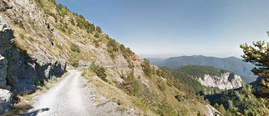
Is the road to Monte Grai unpaved?
The road to reach the summit is mostly unpaved. It’s an old military dirt track called the Military Road of the Vallo Alpino. Unfortunately, the asphalt runs out at approximately 1,550m, and the gravel road up is not in good condition. At this point, the speed is limited to 20km/h, and it’s forbidden for vehicles weighing over 3.5tn.
How long is the road to Monte Grai?
Starting from the paved SP65 road, the ascent is 10.8 km (6.71 miles) long. A 4x4 vehicle is required.
Is the road to Monte Grai open in winter?
Set high in the Ligurian Alps, a mountain range on the border between France and Italy, the road is open to traffic throughout the year. However, the road to the summit may be closed in winter when the weather is bad.