A military road to the summit of Col de la Boaire
Col de la Boaire-Colle della Boaria is an international high mountain pass at an elevation of 2.102m (6,896ft) above sea level, located on the border of France and Italy.
Where is Col de la Boaire-Colle della Boaria?
The pass links the Queyras valley (Hautes-Alpes, France) with Pontechianale (in the province of Cuneo, Piedmont, in Italy).
When was the road through Col de la Boaire-Colle della Boaria built?
The road through the pass was originally built with military functions and was used during the Second World War. It was originally built in the Middle Ages to transport salt from Ventimiglia to Limone Piemonte and from there to Turin. As a result, the road was enlarged, and many sections were expanded and transformed into military roads to connect the numerous forts located along the border between Italy and France.
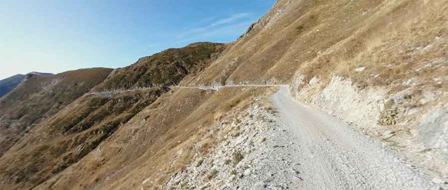
Is the road through Col de la Boaire-Colle della Boaria unpaved?
The road to the summit is entirely unpaved. It’s called Via del Sale. The track is extremely dangerous for cars and must be traveled with extreme caution on any vehicle (best to avoid transit through common cars). The road is entirely unpaved and it is somewhat bad around the pass. The speed limit is 20km/h.
Is Col de la Boaire-Colle della Boaria open in winter?
Set high in the Cottian Alps, the road through the pass is officially closed from November 1 to March 31 every year. Avalanches and heavy snowfalls can block some sections of the road at any time, and the road can be extremely dangerous in winter due to frequent patches of ice. Conditions can change quickly and be harsh.
Is Col de la Boaire-Colle della Boaria worth the drive?
Today, it is a wonderful dirt road that runs along the ridges of the Maritime Alps on the border between Italy and France, offering a wild landscape and stunning views of the sea and the mountains.
Pic: Matteo Quaglia