A bumpy scenic road to Lac de Roterel in the Alps
Lac de Roterel is a high mountain lake at an elevation of 1,941m (6,368ft) above sea level located in the Savoie department in the Auvergne-Rhône-Alpes region of France.
Where is Lac de Roterel?
The lake, also known as Lago di Roterel, is located in the southeastern part of France, near the Italian border, within the La Vanoise National Park, a national park between the Tarentaise and Maurienne valleys in the French Alps.
When was the road to Lac de Roterel built?
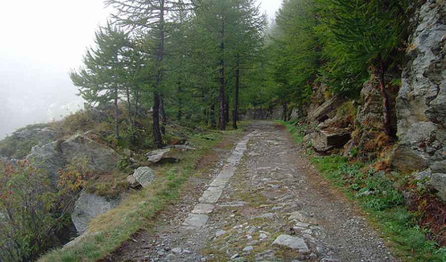
The road to the lake is an old military road built in the 1910s. In some places, it’s possible to see remnants of a former railway line. The French/Italian alpine border is littered with high-altitude military roads dating from the late 1800s and, especially, from WW1.
How challenging is the road to Lac de Roterel in the Alps?
The road to the lake is entirely unpaved and quite bumpy. A 4x4 vehicle is required. The Lac de Roterel former supply route, leading past the forts around Mont Cenis, is a very good alternative to the busy D1006 / SS.25 roads, allowing you to drive without asphalt and encounter very bumpy sections. On the Italian side, the route initially rises over several turns and then follows a ridge just before the border passes through the small lake Lago d'Arpon. On the way to Lac de Roterel, there is a structurally very interesting group of four tight turns with high retaining walls. After the apex, which is around the lake, the road becomes even worse.
Pic: http://farm4.staticflickr.com/3482/3954098150_d3dd884857.jpg