Driving the Unpaved Road to Plateau de Bure in the French Alps: A Moon-like and Star Wars Adventure
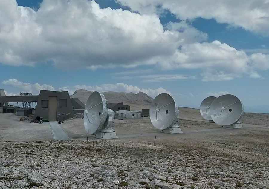
Plateau de Bure is a high mountain plateau at an elevation of 2,560m (8,398ft) above sea level, located in the Hautes-Alpes department of France. It is home to the most powerful submillimeter radio telescope array in the northern hemisphere.

Where is Plateau de Bure?
The plateau is situated in the Provence-Alpes-Côte d'Azur region, in the southeastern part of France.
What’s at Plateau de Bure?
The plateau hosts the NOEMA interferometer of the Institut de Radioastronomie Millimétrique (IRAM), an observatory with ten parabolic antennas, each 15 meters in diameter, dedicated to radio astronomy. Due to its isolated location, a cable car was constructed in the 1980s, but a disaster occurred on July 1, 1999, when the tramway car fell 80 meters (260 ft), killing all 20 occupants. A new cable car was introduced in 2015, but it went out of service after a derailment at the end of 2016.
Is the Road to Plateau de Bure Unpaved?
The road leading to the plateau is completely unpaved and only suitable for 4x4 vehicles. Starting from Le Pré, the challenging road to the summit is 10.3 km (6.4 miles) long. Built in the late 1980s, the drive offers unique, moon-like scenery with panoramic views of the Vercors and Écrins massifs.
Can I Drive to Plateau de Bure?
Located high in the Dévoluy mountain range in the French Alps, the road is impassable in winter due to snow. It is also closed to private vehicles year-round.
Pic: Miguel Montargès