Route de Duranus is an Absolute Must for Scenic Road Lovers
Route de Duranus is a breathtaking drive located in the Alpes-Maritimes department of France. It’s one of the most scenic French balcony roads.
Where is Route de Duranus?
The road is located south of the scenic Gorges de la Vésubie, in the Provence-Alpes-Côte d'Azur region, in the southeastern part of the country, in the Alpes-Maritimes range.
Is Route de Duranus Paved?
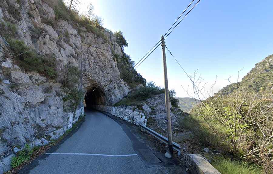
The road is fully paved. It’s called M19 and offers stunning views, winding between towering rock walls and the ravine below. The route features a couple of unlit tunnels and narrow sections. Built on the gray limestone rock overlooking the Vésubie valley, if you feel anxious driving on tight mountain roads, it’s best to avoid this one.
How Long is Route de Duranus?
The staggering road is 12.2 km (7.58 miles) long, running north-south from Saint-Jean la Rivière to Levens. It’s a very scenic drive between a huge rocky wall and the abyss. The drive has vertical rock walls towering above and sometimes over the road. Drive carefully. The dramatic landscapes make for an unforgettable journey.
When is the Best Time to Drive Route de Duranus?
Because it is located just a few kilometers north of Nice, the ravine experiences heavy tourist traffic during the summer months, making the drive challenging. To fully enjoy the journey, it’s best to visit during off-peak times.
How to Get to Le Saut des Français?
The scenery is great, and spectacular views are guaranteed. The road leads to Le Saut des Français, where, in the 18th century (during the 1793-1794 war), local resistance fighters from the County of Nice forced French soldiers to jump to their deaths. It’s over 200 meters down. Le Saut des Français is a historic landmark located along the road. At the end of the 18th century, it was said to be a stronghold of the Barbet resistance against the French Revolutionary troops occupying the County of Nice. According to legend, French soldiers were thrown from the top of this 300-meter-high cliff into the Vésubie Valley below, in retaliation for the atrocities they had committed.
Road suggested by: jorge manuel gómez sánchez