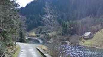
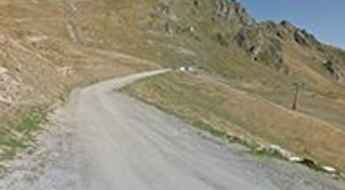
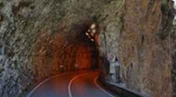
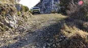
What are the most spectacular roads in France?
Set against the backdrop of Western Europe, France boasts an intricate tapestry of roads that offer some of the most breathtaking drives globally.
Enthusiasts can traverse the famed balcony roads, which cling perilously to cliff faces, ascend the serpentine bends of Col du Chaussy, navigate through the historical Tunnel de Parpaillon, or challenge themselves on the towering peaks of Col de l'Iseran, Col du Jandri, and Col du Télégraphe. From the undulating vineyards and sunlit fields to majestic mountains and turquoise coastlines, France's diverse topography is a treasure trove for those keen on picturesque journeys. The iconic Route Napoleon meanders through the heart of the country, while the shimmering Corniche d'Or offers unparalleled views of the Mediterranean's azure embrace.
But France's roads are more than just pathways carved into its stunning landscapes. They are gateways to its rich tapestry of history, culture, and traditions, from medieval towns and alpine villages to sun-soaked Mediterranean beaches. So, the next time wanderlust calls you to the charm of France, rev up your engine and set forth on an adventure across its most captivating routes.
Pas de Chavanette
Pas de Chavanette is an international high mountain pass on the French-Swiss border atop the ski slopes above Avoriaz at an elevation of 2.147m (7,043ft) above the sea level.
Aiguille Grive
Aiguille Grive is a high mountain peak at an elevation of 2.541m (8,336ft) above the sea level, located in the Auvergne-Rhône-Alpes region in south-eastern France.
Col du Trible: a narrow paved road to the summit
Col du Trible is a mountain pass at an elevation of 540m (1,771ft) above the sea level, located in the Ardèche department in the Rhône Valley in southern France. Be careful: this road is not for the sissies.
Sétaz des Près
Sétaz des Près is a high mountain peak at an elevation of 2.314m (7,591ft) above the sea level, located in the Savoie department in the Auvergne-Rhône-Alpes region in south-eastern France.
Col du Campo
Col du Campo is a mountain pass at an elevation of 452m (1,482ft) above the sea level, located in the Haute-Corse department of France on the island of Corsica.
Barbacana Pass
Passo Barbacana is an international high mountain pass at an elevation of 2.180m (7,152ft) above the sea level in the Alpes-Maritimes, located on the Italian-French border. The pass is reachable by motor vehicles on the Italian side. On the French side it’s just a walking path.
Col de Platé
Col de Platé is a high mountain pass at an elevation of 2.362m (7,749ft) above the sea level, located in the Haute-Savoie department in the Auvergne-Rhône-Alpes region in southeastern France.
Col du Coin
Col du Coin is a high mountain peak at an elevation of 2.275m (7,463ft) above the sea level, located in the Savoie department in the Auvergne-Rhône-Alpes region in south-eastern France.
Col Merciere
Col Merciere is a high mountain pass at an elevation of 2.346m (7,696ft) above the sea level, located in the Alpes-Maritimes department in southeastern France.
Oulles
Oulles is a high mountain town at an elevation of 1.483m (4,865ft) above the sea level, located in the Isère department in southeastern France. With a dozen year-round residents, it’s the smallest village in Isère.
Col de l'Aiguille
Col de l'Aiguille is a high mountain peak at an elevation of 2.606m (8,549ft) above the sea level, located in the Savoie department in the Auvergne-Rhône-Alpes region in south-eastern France.
Fort superieur de Saint-Ours
Fort superieur de Saint-Ours is a military fortress, part of the Maginot Line's Alpine extension, at an elevation of 1.874m (6,148ft) above the sea level, located in the Alpes-de-Haute-Provence department in southeastern France.
Col de Malabergue
Colle Malaberghe is a high mountain pass at an elevation of 2.225m (7,299 ft) above the sea level, located in the Cottian Alps, between France and Italy.
Col des Grands Vans
Col des Grands Vans is a high mountain pass at an elevation of 2.198m (7,211ft) above the sea level, located in the Haute-Savoie department in the Rhône-Alpes region in south-eastern France.
Le Lac
Le Lac is a chairlift at an elevation of 2.487m (8,159ft) above the sea level, located in the Alpes-de-Haute-Provence department in the Provence-Alpes-Côte d'Azur region of southeastern France.
Crete du Lys
Crete du Lys is a high mountain peak at an elevation of 2.421m (7,942ft) above the sea level, located in the Hautes-Pyrénées department and the region of Occitanie in south-western France.
Crete de la Soumaye
Crete de la Soumaye is a high mountain peak at an elevation of 2.348m (7,703ft) above the sea level, located in Saint-Lary-Soulan, a commune in the Hautes-Pyrénées department in south-western France.
L'Autapie
L'Autapie is a high mountain peak at an elevation of 2.409m (7,903ft) above the sea level, located in the Alpes-de-Haute-Provence department in the Provence-Alpes-Côte d'Azur region of southeastern France.
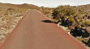
Pas des Sables, a road through a lunar landscape
Pas des Sables is a high mountain pass at an elevation of 2.374m (7,788ft) above the sea level located on the eastern side of Réunion island in the Indian Ocean.
Pointe de Pastourlet
Pointe de Pastourlet is a high mountain pass at an elevation of 2.313m (7,588ft) above the sea level, located in the Hautes-Alpes department in southeastern France.
Pointe des Mossettes
Pointe des Mossettes is an international high mountain pass on the French-Swiss border atop the ski slopes above Avoriaz at an elevation of 2.252m (7,388ft) above the sea level.
Col de la Sagette
Col de la Sagette is a high mountain pass at an elevation of 1.978m (6,489ft) above the sea level, located in the Pyrénées-Atlantiques department in south-western France.
Col de la Petite Forcle
Col de la Petite Forcle is a high mountain pass at an elevation of 2.481m (8,139ft) above the sea level, located in the Graian Alps, in the Savoie department in the Auvergne-Rhône-Alpes region in south-eastern France.
Lago d'Arpon
Lago d'Arpon is a high mountain lake at an elevation of 1.830m (6,003ft) above the sea level located on the border of France and Italy.
Col de Jaffueil
Col de Jaffueil is a high mountain pass at an elevation of 2.494m (8,182ft) above the sea level, located in the Hautes-Alpes department in southeastern France.
A wild military road to Vallon de Savine
Vallon de Savine is a high mountain peak at an elevation of 2.227m (7,306ft) above the sea level, located in the northern Cottian Alps, in the Savoie department in the Auvergne-Rhône-Alpes region in south-eastern France.
Sommet du Becoin
Sommet du Becoin is a high mountain peak at an elevation of 2.311m (7,582ft) above the sea level, located in the Savoie département in the Auvergne-Rhône-Alpes region in south-eastern France.
Road trip guide: 26 hairpin turns to Pas de l’Escous
Pas de l’Escous is a mountain pass at an elevation of 1.012m (3,320ft) above the sea level, located in the Alpes-Maritimes department in the region Provence-Alpes-Côte d'Azur, in France.
Hospice de Rioumajou
Hospice de Rioumajou is a high mountain refuge&restaurant at an elevation of 1.559m (5,114ft) above the sea level, located in the Hautes-Pyrénées department, in the Occitanie region of France.
Coume Lounque
Coume Lounque is a high mountain peak at an elevation of 2.362m (7,749ft) above the sea level, located in the Hautes-Pyrénées department, in south-western France.
Taking on the Twists and Turns of Gorges de la Mescla
Gorges de la Mescla is a very scenic canyon located in the Alpes-Maritimes department, in the Provence-Alpes-Côte d'Azur region of France.
Corna Pass
Pas de la Corne (Passo della Corna) is an international high mountain pass at an elevation of 1.046m (3,431ft) above the sea level, located on the Italian-Franch border.
Col de Chaudun
Col de Chaudun is a high mountain pass at an elevation of 1.693m (5,554ft) above the sea level, located in the Hautes-Alpes department, in southeastern France.
Take the Scenic Route and Discover Bigorno Pass in Corsica
Col de Bigorno is a mountain pass at an elevation of 888m (2,913ft) above the sea level, located in the Haute-Corse department of France on the island of Corsica.
If you love to drive, you will love the pretty D26 road
D26 is the name of a curvy steep road located in the Corse-du-Sud department of France on the island of Corsica.
Travel guide to the top of Le Collu in the Alps
Le Collu is a high mountain peak at an elevation of 1.988m (6,522ft) above the sea level, located in the Haute-Savoie department in the Auvergne-Rhône-Alpes region in south-eastern France.
An old military road to Fort de Dormillouse
Fort de Dormillouse is a military fortress at an elevation of 2.480m (8,136ft) above the sea level, located in the Alpes-de-Haute-Provence department in the Provence-Alpes-Côte d'Azur region of France.
D84, a vertigo paved road in France
D84 is a short narrow mountain road located in the department of Aude, region Languedoc-Roussillon, in southern France. The road is not easy. Not recommended to newbies.
The unfinished Port de Rat Tunnel
Located in the Pyrenees mountain range, the Port de Rat tunnel is an unfinished high mountain tunnel, which had to connect Andorra and France.
If you love to drive, you’ll love the road to Madone d'Utelle
Madone d'Utelle is a high mountain sanctuary at an elevation of 1.177m (3,861ft) above the sea level, located in the Alpes-Maritimes department in Provence-Alpes-Côte d'Azur region, in France.
Colle de Carsene
Colle de Carsene is a high mountain pass at an elevation of 2.221m (7,286ft) above the sea level, located in the Cottian Alps, between France and Italy.
A scenic road to Col de Saint-Barnabé in the French Alps
Col de Saint-Barnabé is a mountain pass at an elevation of 1.368m (4,488ft) above the sea level located in the Alpes-de-Haute-Provence department, in the region of Provence-Alpes-Côte d'Azur in southeastern France.
Col de Muraton
Col de Muraton/ Passo del Muratone is an international mountain pass at an elevation of 1.163m (3,815ft) above the sea level, located on the border of France and Italy.
Col du Couvercle
Col du Couvercle is a high mountain pass at an elevation of 2.282m (7,486ft) above the sea level, located in the Savoie department in the Auvergne-Rhône-Alpes region in south-eastern France.
Travel Guide to Col de Mahourat in the Pyrenees
Col de Mahourat is a high mountain pass at an elevation of 1.740m (5,708ft) above the sea level, located in the Pyrénées-Atlantiques department in south-western France.
