What are the most spectacular roads in France?
Set against the backdrop of Western Europe, France boasts an intricate tapestry of roads that offer some of the most breathtaking drives globally.
Enthusiasts can traverse the famed balcony roads, which cling perilously to cliff faces, ascend the serpentine bends of Col du Chaussy, navigate through the historical Tunnel de Parpaillon, or challenge themselves on the towering peaks of Col de l'Iseran, Col du Jandri, and Col du Télégraphe. From the undulating vineyards and sunlit fields to majestic mountains and turquoise coastlines, France's diverse topography is a treasure trove for those keen on picturesque journeys. The iconic Route Napoleon meanders through the heart of the country, while the shimmering Corniche d'Or offers unparalleled views of the Mediterranean's azure embrace.
But France's roads are more than just pathways carved into its stunning landscapes. They are gateways to its rich tapestry of history, culture, and traditions, from medieval towns and alpine villages to sun-soaked Mediterranean beaches. So, the next time wanderlust calls you to the charm of France, rev up your engine and set forth on an adventure across its most captivating routes.
Sommet de l'Eychauda
Sommet de l'Eychauda is a high mountain peak at an elevation of 2.639m (8,658ft) above the sea level, located in the Hautes-Alpes department in southeastern France.
Col d'Albanne
Col d'Albanne is a high mountain pass at an elevation of 1.652m (5,419ft) above the sea level, located in the Maurienne Valley, in the Savoie department in the Rhône-Alpes region in south-eastern France.
Basèra Pass
Pas de Basèra is an international high mountain pass at an elevation of 2.040m (6,692ft) above the sea level, located on the French-Italian border between Liguria, Piemonte and Provence-Alpes-Côte d'Azur.
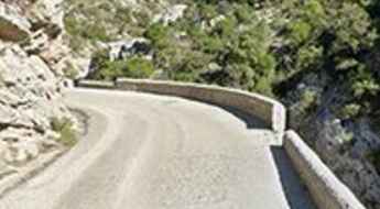
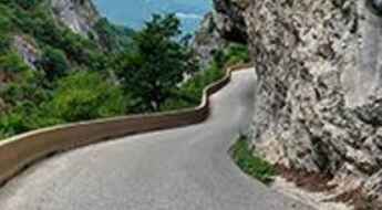
Driving through Gorges de la Cadière, a French balcony road
Gorges de la Cadière is a canyon formed by the Argentesse river, located in the Gard department, in Occitanie region of southern France. It’s one of the famous French balcony roads.
Col Nord des Lacs
Col Nord des Lacs is a high mountain pass at an elevation of 2.533m (8,310ft) above the sea level, located in the Savoie department in the Rhône-Alpes region in south-eastern France.
Col de la Loge
Col de la Loge is a mountain pass at an elevation of 1.002m (3,287ft) above the sea level, located in the Drôme department in southeastern France.
Col du Piéfroid
Col du Piéfroid is a high mountain pass at an elevation of 2.937m (9,635ft) above the sea level, located in the Isère department in the Rhône-Alpes region of south-eastern France. It’s one of the highest roads of Europe.
Road trip guide: Conquering the Col du Vallon
Col du Vallon is a high mountain pass at an elevation of 2.456m (8,057ft) above the sea level, located in the Hautes-Alpes department in southeastern France.
Pla de la Calma-Mollera dels Clots
Pla de la Calma-Mollera dels Clots is a high mountain pass at an elevation of 2.040m (6,692ft) above the sea level, located in the Pyrénées-Orientales and Cerdagne near the Spanish border in the south of France.
Col Gaudissart
Col Gaudissart is a mountain pass at an elevation of 896m (2,939ft) above the sea level, located in the Drôme department in southeastern France.
Auron
Auron is a ski resort at an elevation of 1.652m (5,419ft) above the sea level, located in the French alps in the Alpes-Maritimes department.
Road D71
Located in the Var department in the Provence-Alpes-Côte d'Azur region in southeastern France, the D71 road is a very exciting journey. This is definitely not a Sunday drive. Steep drops and loads of tourists in summer. Visit outside busy periods.
Col de la Biche
Col de la Biche, also known as Golet de la Biche, is a mountain pass at an elevation of 1.310m (4,297ft) above the sea level, located in the Ain department in eastern France. The climbs is exceedingly steep with some sections up to 13.6%.
Col de Plantara
Col de Plantara is a mountain pass at an elevation of 1.002m (3,287ft) above the sea level, located in the Drôme department in the Rhône-Alpes region in southeastern France.
Road trip guide: Conquering the Pas de Bellecombe
Pas de Bellecombe is a high mountain pass at an elevation of 2.361m (7,746ft) above the sea level located on the eastern side of Réunion island in the Indian Ocean.
Col de la Grande Forcle
Col de la Grande Forcle is a high mountain pass at an elevation of 2.270m (7,447ft) above the sea level, located in the Graian Alps, in the Savoie department in the Auvergne-Rhône-Alpes region in south-eastern France.
Les Fonds
Les Fonds is a high mountain town at an elevation of 2.040m (6,692ft) above the sea level, located in the Hautes-Alpes department in southeastern France.
A balcony road through the Gorges de Trente-Pas
Gorges de Trente-Pas is a spectacular canyon carved into the limestone by Ruisseau de Trente-Pas river in the Drôme department in southeastern France. It’s one of the French balcony roads.
Rocher du Charvet
Rocher du Charvet is a high mountain peak at an elevation of 2.712m (8,897ft) above the sea level, located in the Savoie department in the Auvergne-Rhône-Alpes region in south-eastern France. It’s one of the highest roads of Europe.
Crossing the 108m high Pont Du Châtelet
Pont Du Châtelet is the name of a narrow stone bridge located in the Alpes-de-Haute-Provence department in Provence-Alpes-Côte d'Azur region of France. It’s one of the most spectacular bridges in the world.
Col de la Lit
Col de la Lit is a high mountain pass at an elevation of 1.664m (5,459ft) above the sea level, located in the Hautes-Pyrénées department in south-western France.
17 Tournants de Chevreuse, an iconic drive south of Paris
17 Turns of Chevreuse is a legendary motorcycle ride located in the Yvelines department in the Île-de-France, in the south suburb of Paris, in north-central France.
Route de Pierrefitte
Route de Pierrefitte (D920) is a mountain road located in the Hautes-Pyrénées department and the region of Midi-Pyrénées in south-western France.
Col du Teil
Col du Teil is a high mountain pass at an elevation of 1.628m (5,341ft) above the sea level, located in the Aude department of southern France.
Pas des Escaliers
Pas des Escaliers is a high mountain pass at an elevation of 1.700m (5,577ft) above the sea level, located in the Isère department in southeastern France.
Pas de Cherferie
Pas de Cherferie is a high mountain pass at an elevation of 2.142m (7,027ft) above the sea level located in the Savoie department in the Auvergne-Rhône-Alpes region in south-eastern France.
Mont Janus
Mont Janus is a high mountain peak at an elevation of 2.529m (8,297ft) above the sea level, located in the Hautes-Alpes department in southeastern France.
The road to Col de Saluces is not for the faint of heart
Col de Saluces is a high mountain pass at an elevation of 2.445m (8,021ft) above the sea level, located in the Hautes-Alpes department in southeastern France.
Fort de la Grande Maye
Fort de la Grande Maye is a high mountain fort at an elevation of 2.401m (7,877ft) above the sea level, located in the Hautes-Alpes department in southeastern France.
Travel guide to the top of Col de la Ricelle
Col de la Ricelle is a high mountain pass at an elevation of 2.366m (7,762ft) above the sea level, located in the Hautes-Alpes department in southeastern France.
Col de Fours
Col de Fours is a high mountain peak at an elevation of 2.318m (7,604ft) above the sea level, located in the extreme north of the Alpes-de-Haute-Provence, in southeastern France, near the Italian border.
Gorges of Terminet, a balcony road in France
Clue du Terminet is a spectacular canyon formed by Le Sou river in the Aude department in southern France. It’s one of the French balcony roads.
Collada del Vent
Collada del Vent is a high mountain pass at an elevation of 2.301m (7,549ft) above the sea level, located in the Pyrénées-Orientales department in southern France, near the border with Spain and the Autonomous Community of Catalonia.
Col d’Entre les Tetes
Col d’Entre les Tetes is a high mountain peak at an elevation of 2.760m (9,055ft) above the sea level, located in Rhone-Alpes in the French Isère département. It’s one of the highest roads of Europe.
A memorable road trip to Le Brévent
Le Brévent is a high mountain peak at an elevation of 2.484m (8,149ft) above the sea level, located in the Haute-Savoie department in the Auvergne-Rhône-Alpes region in south-eastern France.
Pointe du Dzonfié
Pointe du Dzonfié is a high mountain peak at an elevation of 2.185m (7,168ft) above the sea level, located in the Savoie department in the Auvergne-Rhône-Alpes region in south-eastern France.
How To Have The Ultimate Road Trip To Bocca à Canaghia
Bocca à Canaghia is a high mountain peak at an elevation of 1.848m (6,062ft) above the sea level, located in the Haute-Corse department of France on the island of Corsica. It’s one of the highest roads of Corsica.
Les Tourniquets d'Astoin
Les Tourniquets d'Astoin is the name of the sharply winding and precipitous ascent in a steep and narrow zig-zag road in the Alpes-de-Haute-Provence department in southeastern France.
Collet des Michels
Collet des Michels is a mountain pass at an elevation of 920m (3,018ft) above the sea level, located in the Hautes-Alpes department in southeastern France.
Col de Lachau
Col de Lachau is a mountain pass at an elevation of 1.332m (4,370ft) above the sea level, located in the Drôme department in southeastern France.
Piau-Engaly
Piau-Engaly is a ski resort at an elevation of 1.870m (6,135ft) above the sea level, located in the Hautes-Pyrénées department in southwestern France.
Lac des Estaris
Lac des Estaris is a high mountain lake at an elevation of 2.578m (8,458ft) above the sea level, located in the Hautes-Alpes department in southeastern France.
Tête de la Sallaz
Tête de la Sallaz is a high mountain peak at an elevation of 1.992m (6,535ft) above the sea level, located in the Haute-Savoie department in the Auvergne-Rhône-Alpes region in south-eastern France. The average gradient is 14.74% with some sections up to 20%.
Le Beoux Bridge
Le Beoux pont is located in the Hautes-Alpes department in southeastern France. It’s one of the most spectacular bridges in the world.
Taking on the Twists and Turns of Gorges Du Val de Fier
Gorges Du Val de Fier is a very scenic canyon located on the boundary of the Haute-Savoie and the Savoie departments in the Auvergne-Rhône-Alpes region in France. It’s one of the scenic French balcony roads.
