Driving the 5 stars road to Arlberg Pass in Austria
Arlberg Pass is a high mountain pass at an elevation of 1,804 m (5,918 ft) above sea level, located in Austria.
Where is Arlberg Pass?
The pass is located on the boundary between Vorarlberg and Tyrol, in the western part of the country.
When was Arlberg Pass built?
The first road traversing the pass was built in 1787. At that time, it was called the "Josephinische Straße". In 1824, the road was surfaced. The pass was bypassed by the Arlberg Road Tunnel in 1978.
Is Arlberg Pass paved?
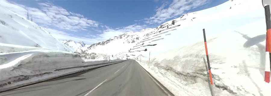
The road to the summit is totally paved. It’s called Federal Highway B 197. The condition of the road is excellent. It is a wide road with moderate curves and just fun to ride, with hairpin turns on the western side. The drive is steep in parts, hitting a 13% maximum gradient through some of the ramps.
How long is Arlberg Pass?
The pass is 13.2 km (8.20 miles) long, running west-east from Stuben am Arlberg to St. Anton am Arlberg. The summit hosts a café-bar and a big parking lot.
Is Arlberg Pass open?
Set high at the northern end of the Rhaetian Alps, the road is usually passable all year round.