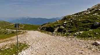
What are the most spectacular roads in Austria?
Covering an area of 83,871 square kilometres and sharing borders with 8 countries (Germany, the Czech Republic, Slovakia, Hungary, Slovenia, Italy, Switzerland and Liechtenstein), Austria is a mountainous country, set high in the central part of Europe.
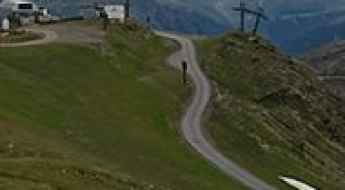
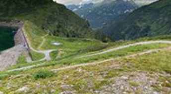
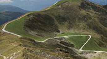
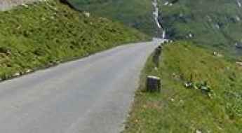
Set high in the Alps, the country provides challenging yet scenic mountain roads for every driver, the scenic Alpine roads, with stunning views of mountains, valleys, lakes, and forests. While in the country, don’t forget to drive the Silvretta High Alpine Road, the Dream Road of the Alps. It’s one of the most stunning and popular panoramic routes in the country. At 22.3 km long, this curvy road encompasses 34 curves and reaches 2.071m (6,794ft) above sea level. Also worth taking is the 48km long drive through the legendary Grossglockner High Alpine Road.
Also, don’t miss the Timmelsjoch, the highest pass of the Ötztal Alps. Also known as Passo del Rombo, is an international high mountain pass on the border with Italy, situated just a few meters below the iconic Passo dello Stelvio. Remember to plan carefully your trip, because Austria has a temperate continental climate, with warm summers and cold winters.
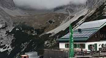
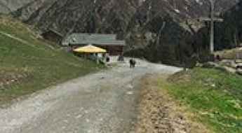
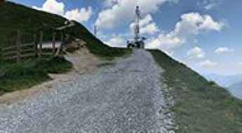
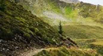
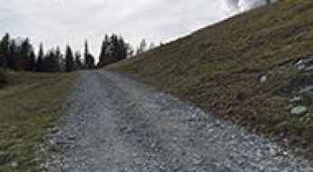
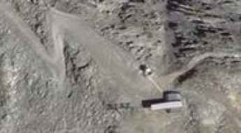
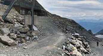
Pfeishütte
Pfeishütte is an Alpine mountain refuge hut at an elevation of 1.926m (6,318ft) above the sea level, located below Mount Sonntagkar in Karwendel, in the Austria’s western state of Tyrol.
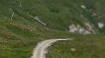
Feistritzer Alm
Feistritzer Alm is a high mountain pass at an elevation of 1.718m (5,633ft) above the sea level, located in the Carnic Alps, on the border of Austria and Italy.
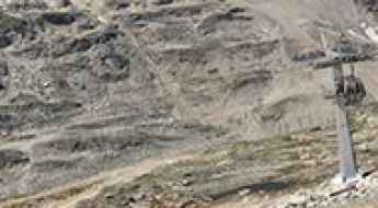
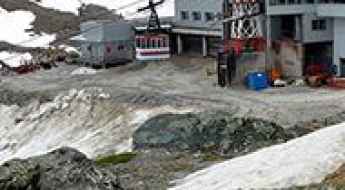
Gletscherexpress Bergstation
Gletscherexpress Bergstation is a high mountain lift at an elevation of 2.842m (9,324ft) above the sea level, located in the Ötztal Valley, in the Austrian state of Tyrol. It’s one of the highest roads of Europe.
Weinflaschenkopf
Weinflaschenkopf is a high mountain peak at an elevation of 2.813m (9,229ft) above the sea level, located in the Austrian state of Salzburg. It’s one of the highest roads of Europe.
Hagener Hütte
Hagener Hütte is a high mountain refuge at an elevation of 2.435m (7,988ft) above the sea level, located on the border of Carinthia and Salzburg, in Austria.
Kitzsteinhorn
Kitzsteinhorn is a high mountain peak at an elevation of 2.738m (8,982ft) above the sea level, located southwest of Salzburg, in Austria. It’s one of the highest roads of Europe.
Schwarzsee
Schwarzsee is a high Alpine lake at an elevation of 2.850m (9,350ft) above the sea level, located in the Austrian state of Tyrol. It’s one of the highest roads of Europe.
Roseggerhaus
The Roseggerhaus is an Alpine hut at an elevation of 1.576m (5,170ft) above the sea level, located in northeastern Styria, Austria.
Unterer Bockhartsee
Unterer Bockhartsee is a high mountain lake at an elevation of 1.869m (6,131ft) above the sea level, located in the Austrian state of Salzburg.
Bergstation Grubenkopfbahn
Bergstation Grubenkopfbahn is a chairlift at an elevation of 2.806m (9,206ft) above the sea level, located in the Austrian state of Tyrol. It’s one of the highest roads of Europe.
Magnetköpfl
Magnetköpfl is a high mountain peak at an elevation of 2.690m (8,825ft) above the sea level, located southwest of Salzburg, in Austria.
Gossenköllesee
Gossenköllesee is a high Alpine lake at an elevation of 2.445m (8,021ft) above the sea level, located in the Austrian state of Tyrol.
Stubnerkogel
Stubnerkogel is a high mountain peak at an elevation of 2.232m (7,322ft) above the sea level, located in the Austrian state of Salzburg.
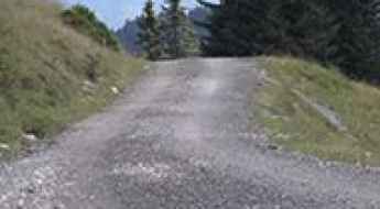
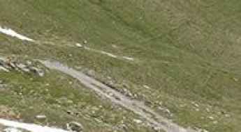
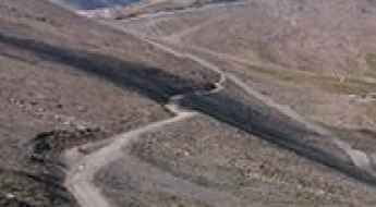
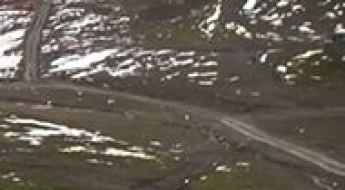
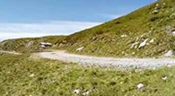
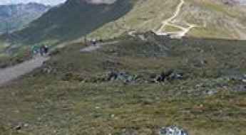
A wild 4x4 road to Sillianer Hütte
Sillianer Hütte is a high mountain refuge at an elevation of 2.428m (7,965ft) above the sea level, located on the border of Austria and Italy.
Einzeiger
Einzeiger is a high mountain peak at an elevation of 2.751m (9,025ft) above the sea level, located in the Austrian state of Tyrol. It’s one of the highest roads of Europe.
Schareck
Schareck is a high mountain peak at an elevation of 2.552m (8,372ft) above the sea level, located in Carinthia, Austria.
Greitspitz
Greitspitz is an international high mountain peak at an elevation of 2.876m (9,435ft) above the sea level, located on the border between Switzerland and Austria. It’s one of the highest roads of Europe.
Zupalseehütte
Zupalseehütte is an alpine mountain refuge at an elevation of 2.339m (7,673ft) above the sea level, located in the Austrian state of Tyrol.
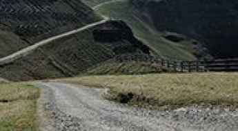
Darmstädter Hütte
Darmstädter Hütte is an Austrian mountain hut in the Tyrolean Alps, at an elevation of 2.383m (7,818ft) above the sea level. The average gradient is 9.1%.
Dobratsch
Dobratsch is a high mountain peak at an elevation of 2.143m (7,030ft) above the sea level, located in the Austrian province of Carinthia, near the Italian and Slovenian borders.
Hohe Mut Alm
Hohe Mut Alm is a high mountain hut at an elevation of 2.652m (8,700ft) above the sea level, located in the Ötztal Alps in Tyrol, Austria.
Palinkopf
Palinkopf is an international high mountain peak at an elevation of 2.863m (9,393ft) above the sea level, located on the border between Switzerland and Austria. It’s one of the highest roads of Europe.
Schattberg West
Schattberg West is a high mountain peak at an elevation of 2.087m (6,847ft) above the sea level, located in the state of Salzburg in Austria.
Hoadl Haus
Hoadl Haus is a high mountain bar at an elevation of 2.338m (7,670ft) above the sea level, located in the Austrian state of Tyrol.
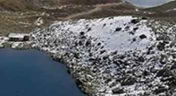
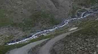
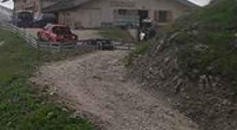
The road to Kaprun reservoir, a chillout in high mountains
Kaprun Hochgebirgsstauseen is a high mountain reservoir at an elevation of 2.038m (6,686ft) above the sea level, located in Salzburg, Austria.
Gipfelbahn
Gipfelbahn is a high mountain peak at an elevation of 2.173m (7,129ft) above the sea level, located in Salzburg in the area of Pinzgau in Austria.
Zeblasjoch
Zeblasjoch is an international high mountain pass at an elevation of 2.535m (8,316ft) above the sea level, located on the border of Austria and Switzerland.
Wildkogel
Wildkogel is a high mountain peak at an elevation of 2.086m (6,843ft) above the sea level, located in Oberpinzgau in Salzburg, Austria.
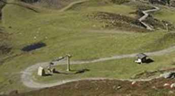
Rotmoosalm
Rotmoosalm is an alpine hut at an elevation of 2.037m (6,683ft) above the sea level, located in the beautiful Gais valley, in the district of Innsbruck-Land in the Austrian state of Tyrol.
Kreuzkogel
Kreuzkogel is a high mountain peak at an elevation of 2.643m (8,671ft) above the sea level, located south of Salzburg, in Austria.
Thurntaler
Thurntaler is a high mountain peak at elevation of 2.390m (7,841ft) above sea level, located in the Austrian state of Tyrol.
Wanglspitz
Wanglspitz is a high mountain peak at an elevation of 2.405m (7,890ft) above the sea level, located in the west Austrian province of Tyrol.
Tuxer Ferner
Tuxer Ferner is a glacier at an elevation of 2.615m (8,579ft) above the sea level, located in the Austrian state of Tyrol.
Schmiedingersee
Schmiedingersee is a high mountain lake at an elevation of 2.392m (7,847ft) above the sea level, located southwest of Salzburg, in Austria.
Z1 Aussichtsplattform
Z1 Aussichtsplattform is an observation deck at an elevation of 2.575m (8,448ft) above the sea level, located in the Austrian state of Tyrol.
Schartenkogel
Schartenkogel is a high mountain peak at an elevation of 2.289m (7,509ft) above the sea level, located in the Austrian state of Tyrol.