Road trip guide: Conquering Port de Rat
Port de Rat is an international high mountain pass at an elevation of 2.372m (7,782ft) above sea level, located on the border of France and Andorra. It's one of the highest roads of the country.
Where is Port de Rat?
Set high in the Pyrenees mountain range, the pass links the parish of Ordino in Andorra and the Ariège department in southern France.
Is Port de Rat unpaved?
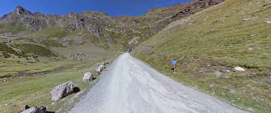
Constructed in the second half of the 20th century, the road to the summit is totally unpaved but navigable by all passenger vehicles in dry weather. However, a 4x4 vehicle is recommended. It’s called CS-380 road. On the French side there’s no road to the summit.
Is Port de Rat open?
Accessibility is largely limited to summer months. To the west of the pass, an unfinished tunnel had to connect Andorra and France. At the summit, a gravel 4x4 rough road climbs up to Refugi Les Portelles, a high mountain refuge-restaurant at an elevation of 2.568m (8,425ft) above the sea level.
Is Port de Rat steep?
The road to the summit is pretty steep, hitting a 9% of maximum gradient through some of the ramps. Starting at the Arcalis parking lot, the ascent is 2.7 km (1.67 miles) long. Over this distance the elevation gain is 148 meters. The average gradient is 5.48%.