Driving the unpaved 4x4 road to Fratosteanu Mare
Frătoșteanu Mare is a high mountain pass at an elevation of 1.914m (6,279ft) above sea level, located in Vâlcea County, in Romania. It’s one of the highest roads in the country.
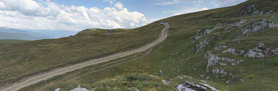
Is the Road to Frătoșteanu Mare Unpaved?
Located south of Sibiu, in the central part of the country, the road to the summit is completely unpaved. It’s called Via Strategica (Strategic Road) and is one of the most spectacular unpaved high roads in the country.
When Was the Road to Frătoșteanu Mare Built?
The road was built by the Germans during the First World War. It had great strategic importance to establish a vital link between Transylvania and Muntenia.
How Challenging is the Unpaved Road to Frătoșteanu Mare?
The road to the summit is rough, rocky, and challenging, with large stones and multiple crossings. Due to its poor condition and steep sections, a 4x4 vehicle is essential. With a 4x2, it is not recommended, as you’ll likely lose grip and may get stuck.
How Long is the Road to Frătoșteanu Mare?
The road to the summit is 8.7 km (5.40 miles) long, running north-south from Curmătura Vidruței, a high mountain pass at an elevation of 1,589m (5,213ft) on the paved DN7A Road, to Saua Repezi, via Belvedere Mogoș, a natural viewpoint at 1,994m (6,541ft) above sea level.
Is the Road to Frătoșteanu Mare Open in Winter?
Set high in the Latoriței Mountains, this road is typically impassable from late October through late June or early July, depending on weather conditions.
Pic: Iesan Andrei