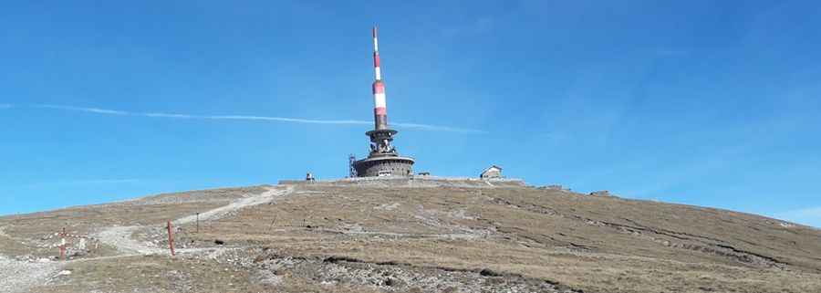
The breathtaking road to Costila Peak in the Bucegi Mountains
Vârful Coștila is a high mountain peak at an elevation of 2,485m (8,152ft) above sea level, located in the mountains of Prahova County in the region of Muntenia, in Romania. It’s one of the highest roads in the country.

Where is Costila Peak?
The peak is located in the south-central part of the country, within the Bucegi Natural Park.
What’s at the summit of Costila Peak?
The peak has a large television tower on it called Releul Coștila (Costila Radio Relay). The tower's height is 84 meters, which results in an altitude of 2,578 meters above sea level, making it the highest artificial point in Romania. The radio and television relay is a strategic objective. In the past, it was guarded by a military unit (UM 02415 Bucharest). Today, access to the relay building is limited by a fence erected around the construction. The relay also serves Radio Trinitas, which began broadcasting from here in 2005, reaching a wide range of counties across Romania.
Why was the tower built?
The construction of the Costila Radio Relay took almost 15 years to complete, according to a report by Radio România Actualități. The materials used to build the station were brought up to Coștila with a funicular and donkeys for the harder-to-reach areas. After the funicular ceased operating, 16-ton tankettes were used, primarily to transport electrical equipment. To build the foundation of the relay, a team of miners was called in to dig into the rock. The station was initially a strategic military objective and was guarded by a military unit. Despite the challenges, the construction process was also marked by an unfortunate event—a fire that melted some of the waveguides of the Russian radio relay "Vesna," which transmitted signals from Moscow to other cities like Sofia, Prague, and Belgrade.
Is the road to Costila Peak unpaved?
The road to the summit is totally unpaved. A 4WD vehicle is required.
How long is the road to Costila Peak?
The road to the summit is called DJ713. Starting at a parking lot at the end of the paved TransBucegi, the road is 8.2 km (5.09 miles) long. The drive is very steep. The elevation gain is 560 meters, and the average gradient is 6.82%.
Is the road to Costila Peak open?
Set high in the Bucegi Mountains, this road is usually impassable from late October through late June or early July. It’s closed to private vehicles. In the past, the relay on Coștila was guarded by a military unit. Today, access to the relay building is limited by the fence around the construction.
Pic: Petre Petrica