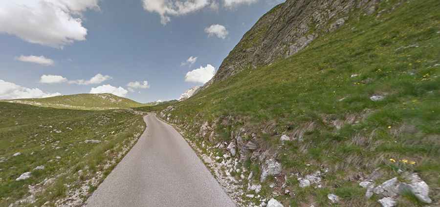
P14 is a scenic road above the clouds in Montenegro
P14 is a spectacular mountain road straddling Plužine and Šavnik municipalities in Montenegro. This route is considered extremely dangerous during the winter.
How long is P14 road?
Running across the Durmitor National Park, the road, also known as Durmitor Panoramic Route or Durmitor Ring, is totally paved but full of potholes. It’s 49.7 km (30.8 miles) long, running east-west from Žabljak (the city on the highest altitude of the Balkans) to Plužine.
Is P14 road in Montenegro challenging?
Tucked away in the northwestern part of the country, the road is pretty challenging, with unlit tunnels (extremely dusty) and narrow parts. In fact, it’s so narrow that requires that at least one car pull over in order for another to pass. The road is very steep, with some dangerous drop off without protections. This narrow road requires give and take with oncoming drivers. While this is generally safe, there are multiple high points with massive drop offs along the way. Due its dangerousness, this road will be bypassed in the future by a motorway which is currently being planned.
How long does it take to drive P14 road?
To drive the road without stopping will take most people between 1.5 and 2 hours running through breathtaking mountain scenery and traditional villages. In its vicinity is the deepest canyon in Europe, the canyon of the Tara River.
Is P14 road in Montenegro dangerous in winters?
The road tops out by Sedlo Pass at 1.907m (6,256ft) above the sea level. It’s said to be the highest paved mountain pass in the country. This route is usually closed in winters due to heavy snowfalls. It is recommended that one takes the bus to the north during the cold or rainy days, as bus drivers are experienced and know the road. Do not rely on signage to tell if the road is passable. The locals are the best source of info on changing road conditions.