A 4x4 road only for experienced drivers to Lako Signoj Peak
Lako Signoj (Signoy) is a high mountain peak at an elevation of 1,975m (6,479ft) above sea level, located in the Republic of North Macedonia. It's one of the highest roads in the country.
Where is Lako Signoj Peak?
The mountain is located in the southwestern part of the country, near the Albanian border, within the National Park Galichitsa.
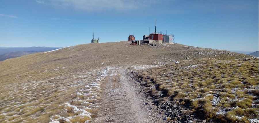
What’s at the summit of Lako Signoj Peak?
The summit hosts a few communication facilities. Along the way, there are some caves, which were dug during World War I (there was a line of battle across the Galičica).
How long is the road to Lako Signoj Peak?
The road to the summit is totally unpaved. 4x4 vehicles with high clearance only. Starting from Livada Pass, at an elevation of 1,599m (5,246ft) above sea level, on the paved P504 road, the ascent is 2.8 km (1.73 miles) long. Over this distance, the elevation gain is 382 meters. The average gradient is 13.64%.
Is the road to Lako Signoj Peak worth the drive?
The summit offers beautiful views of Ohrid and Prespa Lakes. From the top, you can see three countries on a clear day — North Macedonia, Greece, and Albania.
Is the road to Lako Signoj Peak open in winter?
Set high in the Galičica Mountains, the road is usually impassable from November 1st to mid-March. Even in summer, the road is a bit difficult due to potholes that occur during the winter months.
Pic: Toni Krstanovski