Zekari Pass: Ultimate 4wd destination
Zekari Pass is a high mountain pass at an elevation of 2.157m (7,076ft) above sea level, located on the boundary between Imereti and Samtskhe-Javakheti regions, in Georgia.
Is Zekari Pass unpaved?
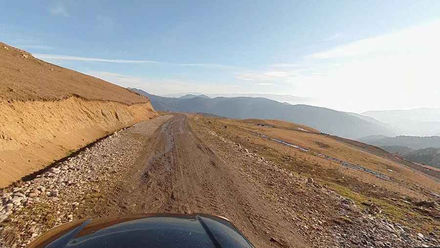
Located in the southwestern part of the country, the curvy road to the summit, also known as Zikar Pass, is totally unpaved. It’s called SH14. Though used as a 'caravan' route since times immemorial, the road is suitable only for off-road vehicles. The road is in awful shape.
How long does it take to drive through Zekari Pass?
To drive the road without stopping will take most people between 2 and 3 hours. Periods of heavy rain make the road undrivable.
Is Zekari Pass worth it?
In the vicinity of the pass, there is a large observatory of the Georgian Academy of Sciences. Opened in 1932, it was the first high-mountain observatory in the USSR. It is still in operation today. You can get to the observatory by cable car; registration is recommended. On the pass itself, in the middle of the route, there are a large number of shepherd camps.
Is Zekari Pass open?
Set high in the Meskheti Range, the road is usually impassable from October to June (weather permitting). Winding through wonderful mountain areas, off-roaders will love this route and the terrain.
How long is Zekari Pass?
The pass is 39.2 km (24.35 miles) long, running north-south from Sairme to Abastumani (an ex-Soviet mountain resort or rather sanatorium area in the Borjomi-Kharagauli National Park). The road tops out at 2.275m (7,463ft) above sea level, to the north of the pass.
Pic: Vasyl Haievyi