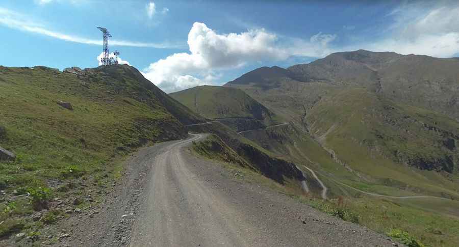
Abano Pass is a Georgian treacherous road closed in winters
Abano Pass is a high mountain pass at an elevation of 2,864m (9,396ft) above sea level, located on the boundary between Kakheti and Tusheti regions of Georgia.

Where is Abano Pass?
The pass, also known as Torgva Pass, is located in the central part of the Great Caucasus Mountains, in the eastern part of the country, near the Russian border. Due to its high mountain location and the absence of well-maintained roads, it is largely isolated from the rest of Georgia for most of the year.
Can I drive through Abano Pass?
The road to the summit is entirely unpaved, classed as a national route, and numbered M44 (მ44). The pass is 67.2km (41.75 miles) long, running south-north from Pshaveli (in Kakheti region) to Omalo (in the historical region of Tusheti). The main settlement in the region is Omalo Village (1850m asl). Note for travelers: Some homestays are often only open from July, but a bit of preplanning will ensure you have somewhere to stay. The road is not for the faint of heart and can be dangerous if your car is not up to the task, you try to go up in poor weather, or if your driver is drunk (some drivers take shots of cha-cha on the way up, simply ask that they don't). However, it is worth the effort as the drive is simply stunning.
Is Abano Pass open?
At this elevation, it is the highest drivable mountain pass in the Caucasus. It is only open during the summer months from around May to October (depending on weather conditions). It needs constant attention, and there are many emergency callouts to clear landslides or spots where the road has slipped away. Landslips are a problem and can close the road for days. Due to weather and road conditions, especially in the mountains, caution is required. Once over the magnificent Abano Pass (don’t miss the wildflowers and keep an eye out for the cloud cover), the journey gets more exciting, depending on the previous winter. In the summer of 2008, the road cut through the previous winter’s snow approximately 4 meters deep, and that was in July. In the summer of 2009, there was a period in late July when the rainfall made part of the road impassable for a while, but this is not uncommon. The road will always dry out; you might just be held up for a couple of days.
Is Abano Pass challenging?
The road to the summit is very challenging and difficult, being one of the highest roads in Georgia. The road is open to 4x4 vehicles with high clearance only. The drive features steep sections, hitting a 17% maximum gradient through some of the ramps. Along the way are numerous roadside memorials to those who have perished on the road. Ten to twelve people attempting to cross the pass die every year. Situated deeply in the beautiful Caucasus mountains, it is well known as a "death road" because of many fatal accidents. Clinging to cliff sides and carving along the bottom of deep gorges at the foot of towering cliff faces, the road is a combination of a rough and unpredictable surface, seemingly endless tight turns, steep climbs, no guardrails, deep gorges, and gushing waterfalls. Animals are frequently encountered on the way.
When was the road to Abano Pass built?
The road to the summit, known as აბანოს უღელტეხილი, was built by the Soviets in 1978.
Is Abano Pass worth it?
The summit hosts a little chapel and sometimes, a little temporary coffee shop known as "Above the Clouds" is open up there. The road through the summit appeared in an episode of the BBC’s "World’s Most Dangerous Roads" a few years ago. To the west of the pass, a brutal minor gravel road climbs up to a few communication towers at 2,881m (9,452ft) above sea level, known as Alazani Pass (უღ. ალაზანი) according to Google Maps. The road is 300m long and is suitable for 4x4 vehicles with high clearance only due to the rugged surface and steepness.
Pic: Nickolay Omelchenko