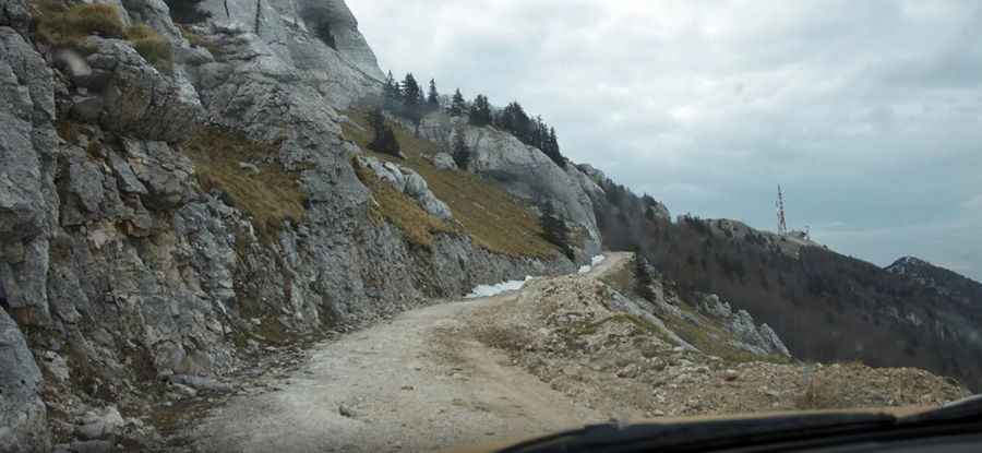
How can I get by car to Gola Plješevica?
Gola Plješevica is a high mountain peak at an elevation of 1,547m (5,075ft) above sea level, located on the border of Croatia and Bosnia and Herzegovina.

Where is Gola Plješevica?
The peak is situated on the border between Lika-Senj County in Croatia and Una-Sana Canton in the Federation of Bosnia and Herzegovina.
What’s at the summit of Gola Plješevica?
The summit features an abandoned building, transmitter towers, and radars. Until 2007, access was restricted because the road and some buildings were under military control.
How dangerous is Gola Plješevica?
Set high in the Dinaric Alps, according to some local rumors, certain areas off the road and close to the ridge are considered hazardous due to possible minefields.
Is there a road to Gola Plješevica?
On the Croatian side, the road to the summit is completely unpaved, with loose rocks, narrow sections, and dangerous drop-offs. It is suitable for 4x4 vehicles only. Starting from Kapela Korenička, the road to the summit is 8.1 km (5.03 miles) long. Over this distance, the elevation gain is 808m, and the average gradient is 9.97%.
There is no road to the summit on the Bosnia and Herzegovina side.
Pic: Jure O