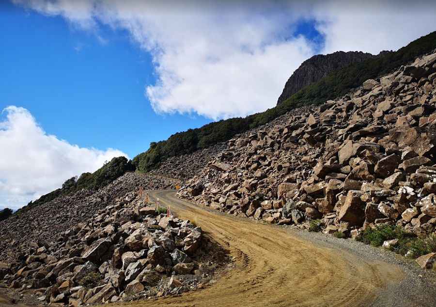
The road to Mount Barrow is worth the white-knuckle drive
Mount Barrow is a high mountain peak at an elevation of 1,359m (4,458ft) above sea level, located in Tasmania. If you don’t like heights or twisty dirt roads, this drive is not for you. It's one of the most scenic drives in the world.

Where is Mount Barrow?
The peak is located in the northeastern part of the country, just east of Launceston, within the Nunamara Forest Reserve.
Can you drive up Mount Barrow?
The one-way road to the summit is totally unpaved, pretty narrow, and challenging. It’s called C404 (Mount Barrow Road). Starting at the paved A3, it’s 16.1 km (10 miles) long to the summit. The first 10km of the route has a well-maintained gravel surface and runs through a combination of undulating farmland and forestry areas. The boundary of Mount Barrow State Reserve is reached at the 10km mark, where parking and picnic areas are provided. The road beyond the parking area is officially closed to vehicles other than 4WDs but worth the drive. It comprises tortuous, steep switchbacks - rivaling nearby Jacobs Ladder - but also provides spectacular views of the valleys to the north and west. The road to the summit is very steep, reaching a maximum gradient of 16% through some of the ramps. The elevation gain is 1,027 meters. The average gradient is 6.37%.
Is Mount Barrow open?
The road to the summit is periodically closed in winter due to snow, with the snow line located at around 1,100 meters (3,609 ft). The last 1.5km of the road is above the tree line, at around 1,000m above sea level, and is the nearest location to Launceston that regularly receives winter snowfalls. This gravel road is sometimes in poor condition, especially in winter, so 4WD vehicles are recommended. For safety reasons, only 4WD vehicles are allowed on the mountain when it is snowing.
How long does it take to drive to Mount Barrow?
To drive the road without stopping will take most people between 45 and 60 minutes. The drive offers stunning views. The summit hosts facilities for TV, radio, and aircraft navigation. It’s the main television and FM radio transmission site for northeast Tasmania. Broadcast Australia’s Mt. Barrow transmission site overcomes extreme weather conditions to deliver television and radio services to Tasmania’s north. At the summit, there is a very impressive panoramic view of both the Tamar Valley and the mountains to the east.
Pic: celloloo