Taking on the Twists and Turns of Crown Range Summit in NZ
Crown Range Summit is a mountain pass at an elevation of 1,079m (3,540ft) above sea level, located in Otago in the southwest of New Zealand's South Island.
How long is the road through Crown Range Summit?
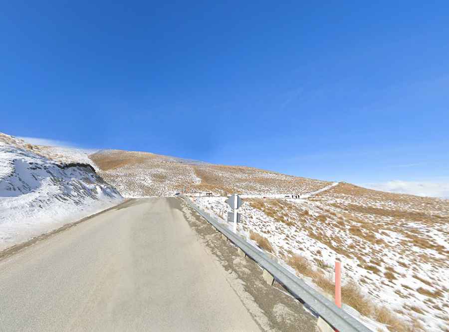
The road to the summit is entirely paved. It’s called Crown Range Road, formerly State Highway 89. It spans 50km (31 miles) from Arrow Junction to Wanaka. Known for its sharp curves and potential dangers, this road features hairpin turns, making it unsuitable for the faint-hearted or inexperienced drivers. The descent offers stunning but perilous views of a deep gorge. Due to its challenging nature, Crown Range Road is not recommended for beginners, towing vehicles, or those with vehicles longer than approximately 12 meters.
Is Crown Range Summit open in winters?
Situated in the Crown Range of the dramatic Southern Alps, it is said to be the highest main road in New Zealand. While open year-round, winter (May-October) presents challenges, with the summit often covered in snow and ice. Winter driving demands extreme caution, and snow chains are a necessity.
Is the road through Crown Range Summit worth it?
Despite its difficulties, the journey along Crown Range Road offers spectacular mountain views and breathtaking vistas at every turn. Numerous stops are encouraged to appreciate the stunning scenery, with the descent into the alpine valley providing particularly captivating late afternoon views. The drive typically takes around 1.30 hours without stops. However, the awe-inspiring views may prompt frequent stops for photography, and drivers should be prepared for varying traffic conditions.