What are the most spectacular roads in New Zealand?
Located in the southwestern Pacific Ocean, New Zealand is an island country that comprises two main landmasses: the North Island and the South Island, with around 700 smaller islands. Similar in size to Italy or Japan, it covers an area of 268,680 km2 (103,740 sq mi).
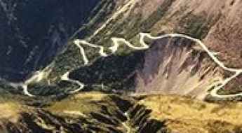
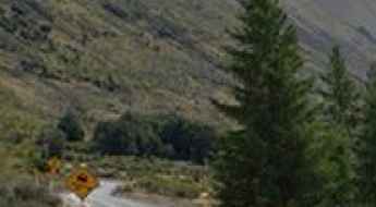
Due to its geography, with mountain ranges, fjords, volcanic plateaus, and coastal plains, it features some of the most spectacular roads in the world. When traveling to New Zealand, you can not miss driving Skippers Canyon Road. Tucked away in the southwest of the South Island, it is now one of New Zealand's better-known scenic roads and is unbelievably scary, being extremely narrow and difficult to maneuver.
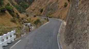
For those who prefer scenic drives, the Forgotten World Highway is one of the world's top drives. It’s also worth driving the scenic Crown Range Road, an exhilarating road with hairpin bends, serpentines, and steep grades on the South Island. And if you prefer mountain roads, you can not skip the sensational road to the Remarkables in Queenstown, a ski resort at 1,622m (5,321ft) above sea level. And do not forget to check out our content about the highest roads in the country, where altitude and adventure pose a breathtaking challenge.
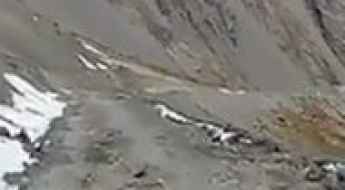
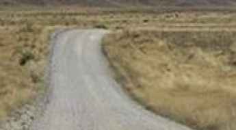
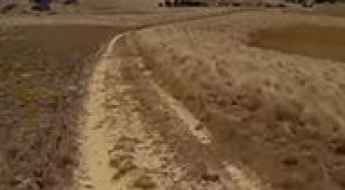
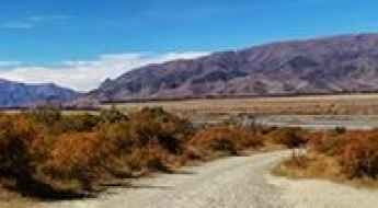
Driving the unpaved road to Mount Dobson in NZ
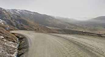
Mount Dobson is a ski resort at an elevation of 1,748m (5,734 ft) above sea level located in the Mackenzie region of the South Island in New Zealand. It’s one of the highest roads in the country.
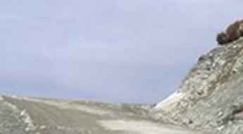
Mount Olympus: a road impassable without a 4wd, snow chains and nerves of steel
Mount Olympus is a high mountain peak at an elevation of 1.643m (5,360ft) above sea level located on New Zealand's South Island. The road to the summit is best negotiated by a high-clearance 4WD that can be equipped with chains if required. It’s one of the highest roads in the country.
Driving to Island Saddle, the Highest Public Road in New Zealand
Island Saddle is a high mountain pass at an elevation of 1.371m (4,498ft) above sea level located in New Zealand. At this elevation, it’s said to be New Zealand's highest public road.
Driving the steep unpaved road to Ohau Snow Fields in the Mackenzie High Country
Ōhau Snow Fields is a ski resort at an elevation of 1.469m (4,819ft) above sea level located in the Mackenzie High Country, not far from the Mt Cook region on the South Island of New Zealand.

The defiant Otaki Gorge Road in New Zealand is closed after a big slip
Otaki Gorge Road is a very scenic yet challenging drive following the Otaki River, in the Kapiti Coast District of the North Island of New Zealand. The drive has a history of slips and road damage in heavy rain events.
The road to Wards Pass is closed due to snowfalls for long periods
Wards Pass is a mountain pass at an elevation of 1.145m (3,757ft) above sea level, located in New Zealand's northern South Island.
Driving the Unsealed and Challenging Road to Mount Cheeseman
Mount Cheeseman is a mountain peak at an elevation of 1,550m (5,085ft) above sea level, located on New Zealand's South Island. It’s one of the highest roads in the country.
Travelling The Zigzag, a dangerous road in New Zealand
The Zigzag was part of the old Arthur's Pass road in Arthurs Pass National Park, located in the center of New Zealand's South Island. This section was on State Highway 73 (SH 73), which crosses a mountainous area.
Driving the Dangerously Narrow Scenic Road Through Takarau Gorge
Takarau Gorge is a stunning canyon located in the southern part of Te Ika-a-Māui (North Island), New Zealand. Sections of this road are often closed due to flooding.
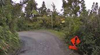
How to get by car to Whatipu Beach?
Whatipu Beach is a remote black sandy beach located on the wild west coast of the Auckland region of the North Island of New Zealand.

A Journey on the Legendary Tasman Valley Road 4X4 Track in NZ
Tasman Valley Road 4X4 Track is a very scenic yet challenging drive located on New Zealand's South Island.
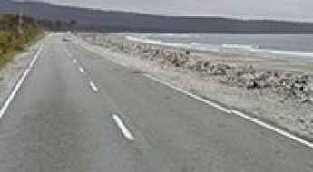
Driving the Scenic Haast Highway Along the West Coast of the South Island
Haast Highway is a breathtaking and scenic drive along the West Coast of New Zealand's South Island. It's considered one of the most spectacular coastal drives in the world.
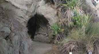
Waikawau Tunnel Beach was cut with picks and shovels
Located on the West Coast of the North Island of New Zealand, the narrow Waikawau Tunnel Beach is used by people for accessing Waikawau Beach.
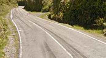
Driving the scenic Pembroke Road in NZ
Pembroke Road is a very scenic drive located in the Taranaki region, on the western coast of New Zealand's North Island. The road is quite steep, with an average gradient of 5.75%.
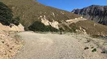
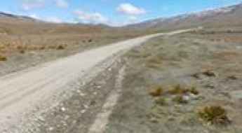
Driving the Wild 4x4 Road to Old Woman Range
Old Woman Range is a high mountain peak at an elevation of 1,739m (5,705ft) above sea level, located in New Zealand’s Otago region. It’s one of the highest roads in the country.
The Ultimate Guide to Traveling the Karamea Highway
Karamea Highway is a scenic drive at the northernmost end of the South Island's West Coast of New Zealand.
How to get by car to Waipu Gorge in New Zealand's North Island?
Waipu Gorge is a scenic gorge located in the Northland Region in the heart of New Zealand's North Island. The road through the gorge provides access to Piroa Falls.

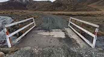
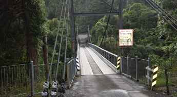
Crossing the historic Bertrand Road Swing Bridge
Located in the northern part of the Taranaki region, in New Zealand, the Bertrand Road Swing Bridge is one of the most spectacular bridges in the world.
Duffers Saddle is a challenging 4WD road in NZ
Duffers Saddle is a high mountain pass at an elevation of 1,275m (4,183ft) above sea level, located in Central Otago, New Zealand.
The Ultimate Guide to Traveling the Lake Ohau Road
Lake Ohau Road is a very scenic drive located in the Ohau Range in the Mackenzie High Country, not far from the Mt Cook region on the South Island of New Zealand. The road features both paved and unpaved sections.
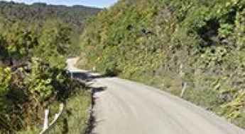
Driving the Narrow Kiwi Road in Taranaki's Most Isolated Countryside
Kiwi Road is a scenic, narrow, and rough track located in northern Taranaki, on the North Island of New Zealand.
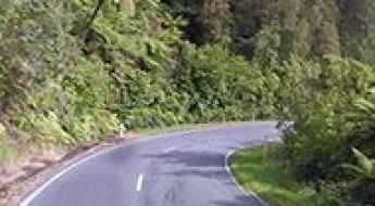
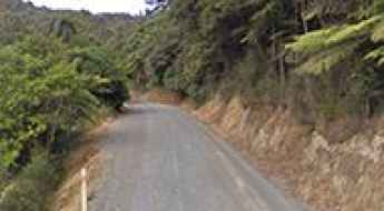
A Most Tricky Scenic Drive to Remutaka Pass in NZ
Remutaka Pass is a mountain pass at an elevation of 556m (1,824ft) above sea level, located in New Zealand's North Island. The road is well known to NZ motorcyclists.
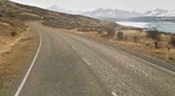
Top coastal road trips in the South Island of New Zealand
The South Island, also known as Te Waipounamu, offers some of the New Zealand’s most beautiful coastal drives. The island hosts the purest natural landscapes you’ll ever experience. There are lots of places to stop, little hidden bays and places to take in the scenery. From wildlife to wineries, from glacial valleys to star-filled skies, nature's best flourishes against a palette of dramatic scenes.
Aramoana Road is one of the most beautiful coastal drives in the world
Aramoana Road is a very scenic coastal drive located on the South Island of New Zealand. It's one of the most beautiful coastal drives in the world.
How To Travel The Road To Cardrona Alpine Resort
Cardrona Alpine Resort is a ski resort at an elevation of 1.660m (5,446ft) above the sea level, located in the heart of the South Island of New Zealand. It’s one of the highest roads of the country.
A scenic drive through the Pomarangai Road
Pomarangai Road is a very scenic drive running through the Whareorino Forest, in the western King Country of New Zealand.
Obelisk/Kopuwai
Obelisk/Kopuwai is a high mountain peak at an elevation of 1.687m (5,534ft) above the sea level, located on the Old Man Range, in the Otago region of New Zealand. It’s one of the highest roads of the country.
How to Cross the Defiant Kaitawa Bridge in the Manawatū Region?
The Kaitawa Bridge is located in the Manawatū Region, on the North Island of New Zealand. It’s one of the most spectacular bridges in the world.
Driving the unsealed Lake Road in NZ
Lake Road is an amazing unsealed road located in the North Island of New Zealand. The road leads to the Lake Waikaremoana, in the heart of Tuhoe country.
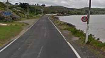
Driving the scenic Harington Point Road
Harington Point Road is a coastal drive located at the northeastern end of Otago Peninsula, in New Zealand's South Island.
Whaanga Coast Road, an iconic rally challenge in NZ
Located in the Waikato region of New Zealand’s North Island, Whaanga Coast Road is a rugged, rocky, gravel road that has become a legend.
A scenic coastal road to Tapotupotu Beach
Tapotupotu Beach is an unspoilt beach located the Aupouri Peninsula, at the northern end of the North Island of New Zealand.
Sawcut Gorge
Located in the north east of the South Island of New Zealand, the Sawcut Gorge is a lovely place to be on a hot day, with excellent swimming holes and towering rock faces.
Henderson Bay Road
Henderson Bay Road is a short metal road connecting Henderson Bay to the State Highway 1. This very quiet little road is 6km long and is located north of Kaitaia, the northern most city in New Zealand.
The unpaved winding road to Cardrona Alpine Resort
Located in the Otago region of the South Island of New Zealand, at an elevation of 1.648m (5,406ft) above the sea level, Cardrona Alpine Resort is one of most popular ski resorts of the country.
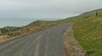
Omarama Clay Cliffs
The Omarama Clay Cliffs are silt and gravel pinnacle formations near the southern end of the Mackenzie Basin, in the South Island of New Zealand. The road is bumpy, drive slowly and avoid holes!