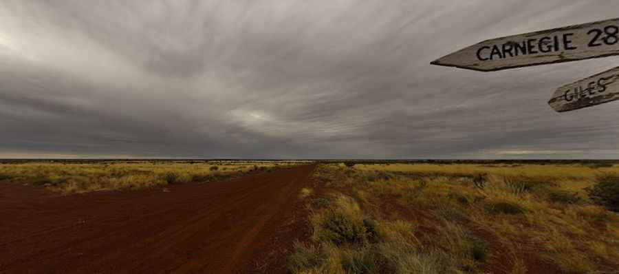
Gunbarrel Highway is one of Australia’s best 4WD tracks
Gunbarrel Highway is one of Australia's most famous and challenging tracks, running through some of the remotest areas in the country. It’s one of Australia’s best 4WD tracks.

Gunbarrel Highway is one of Australia's most famous and challenging tracks, running through some of the remotest areas in the country. It’s one of Australia’s best 4WD tracks.
How long is the Gunbarrel Highway?
The road is 1,350 km (840 mi) long and links Carnegie Station (central Western Australia) with the Meteorological Station at Giles (west of the Northern Territory border). It’s part of the 2,800 km (1,740 mi) long Outback Highway (or Outback Way). Along the way, you’ll encounter washaways, heavy corrugations, stone, sand, and flood plains.
What is the condition of the Gunbarrel Highway?
The track varies from stony to sandy with corrugations, ruts, washaways, and sometimes mud. Parts of the track are only suitable for high clearance four-wheel-drive vehicles and should only be attempted by confident drivers. This is for experienced desert travelers, and your vehicle needs to be tough. Completed in 1958, it receives very little attention, and in fact, some sections have not been graded since the original days of construction. Only experienced four-wheel drivers with confidence in themselves and their vehicles should attempt this trip.
How long does it take to drive along the Gunbarrel Highway?
Allow a minimum of 4 days. Don't make this your first desert adventure. The Gunbarrel Highway has important historical significance.
How remote is the Gunbarrel Highway?
Traversing through an extremely remote section of the Australian outback, the route demands travelers to be entirely self-sufficient, carrying their own water, food, and fuel. The longest stretch between fuel stations spans 489 kilometers, stretching from Warburton to Carnegie Station. This isolated journey offers sparse towns and fuel stops, necessitating travelers to remain vigilant about road and weather conditions throughout their trip. Undoubtedly, this route presents a challenging and lengthy trek through rugged terrain. It's advisable to steer clear of the summer months due to the harsh conditions. Supplies and services are limited, and road conditions can vary, so plan ahead, stock up on food, water, and fuel, and search for up-to-date track information.
Pic: David Rowley