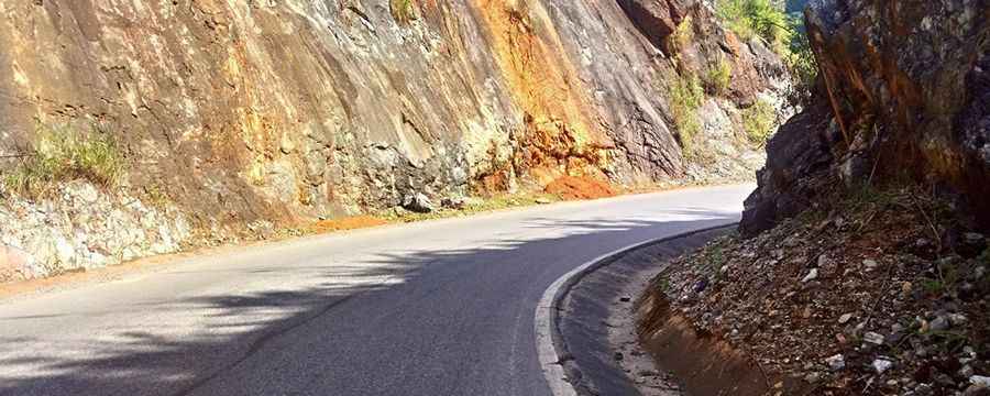
The road to Pha Din Pass is flanked by deadly drops
Pha Đin Pass is a high mountain pass at an elevation of 1,648m (5,406ft) above sea level, located in Vietnam. The road is rugged, with cliffs on one side and a sheer abyss on the other.
Where is Pha Din Pass?
The pass is located on the boundary between Sơn La and Điện Biên provinces, in the northwestern part of the country. Pha Đin, in the local language, means "Heaven and Earth." It is considered one of the four great mountain passes of Vietnam.
Why is Pha Din Pass important?
Pha Din Pass played a crucial role in transporting supplies for Vietnamese forces during the Điện Biên Phủ campaign (1954). To disrupt this route, the French launched relentless air raids on National Road 6, heavily bombarding Pha Din Pass and the Cò Nòi intersection for 48 days and nights. Today, a memorial plaque atop the pass honors this historic struggle.
How challenging is the road through Pha Din Pass?
The road to the summit is fully paved. It’s called QL6-AH13. The winding road is extremely dangerous, with eight terrifying hairpin turns, just wide enough for a single car to pass. There are many perilous bends, narrow pathways, and sections that can only accommodate one vehicle at a time. The 32-kilometer stretch constantly zigzags, flanked on one side by towering rock walls and on the other by deadly drops. If you have a fear of heights, it's best to avoid this road.
How long is the road through Pha Din Pass?
The road through the pass is 32km (20 miles) long. It runs west to east, from Phỏng Lái (in Thuận Châu District, Sơn La Province) to Tuần Giáo (in Tuần Giáo District, Điện Biên Province).
Pic: Hải TC