Travel guide to the top of Khau Pha Pass
Đèo Khau Phạ is a high mountain pass at an elevation of 1,500m (4,900ft) above sea level, located in Yên Bái Province, Vietnam. It is said to be one of the longest mountain passes in the country.
Where is Khau Pha Pass?
The pass is located on the boundary between Văn Chấn District and Mù Căng Chải District, in the Northeast region of Vietnam.
Is Khau Pha Pass paved?
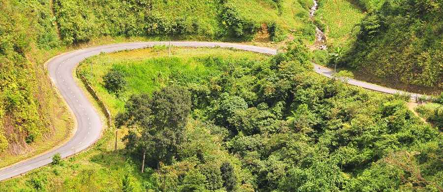
The road to the summit is fully paved and is known as National Highway 32. However, it is considered dangerous due to thick fog, occasional snowfall in winter, sharp bends, lack of barriers or warning signs, poor maintenance, and frequent landslides.
How dangerous is Khau Pha Pass?
Khau Pha Pass is considered one of the most dangerous roads in Vietnam, attracting many adventurous travelers, including foreigners eager to explore it. The drive features dozens of sharp bends, making it particularly hazardous on foggy days due to the absence of barriers and warning signs. The pass has deteriorated over time due to poor maintenance and sits on weak red basalt soil, which is prone to erosion and landslides. Additionally, the risk of falling rocks poses a constant danger.
How long is Khau Pha Pass?
The road stretches 125km (78 miles), running from Nghĩa Lộ to Ban La. Due to its challenging terrain, the journey takes considerable time to complete. The best time to visit is during the autumn months from September to November, when the weather is most favorable, and the natural scenery is at its most breathtaking.
Pic: Phuong NguyenThanh