How to Get to Doi Ang Khang by Car?
Doi Ang Khang is a high mountain pass at an elevation of 1,815m (5,954ft) above sea level, located in Fang District, in the Chiang Mai Province of Thailand. The mountain is referred to as Thailand's 'Little Switzerland' due to its cool climate and mountain scenery.
Where is Doi Ang Khang: Thailand's Little Switzerland?
Set high in the Daen Lao Range, the pass is located in the northern part of the country, near the Myanmar (Burma) border, within the Doi Pha Hom Pok National Park.
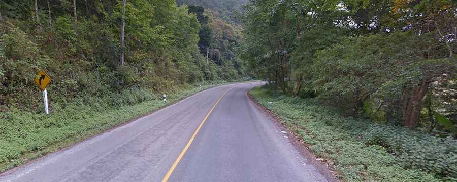
Is the Road to Doi Ang Khang Paved?
The road to the summit, also known as Doi Angkhang, is called Route 1249. It is a steep, zigzagging paved road with a maximum gradient of 19% (for 0.4 km). Therefore, only vehicles in good condition with experienced drivers can make the trip.
How Long is the Road to Doi Ang Khang?
The road through the summit is 25.1 km (15.59 miles) long, running north-south from Ang Khang to หมู่ 1.
Is Doi Ang Khang Worth It?
If you plan on visiting this great country, be sure to check out this helpful list of what to pack for Thailand. There are fantastic views from this route, but keep your eyes on the road as there are also some very steep switchbacks. As the road is very windy and there’s no public transportation to or within Doi Angkhang, hiring a driver is recommended if you feel uncomfortable navigating the steep hairpin turns uphill and downhill yourself.