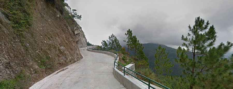
A narrow and rough road to Mount Santo Tomas
Mount Santo Tomas is a stratovolcano at an elevation of 2,224m (7,296ft) above sea level, located in the province of Benguet, on Luzon Island of the Philippines.
What’s at the summit of Mount Santo Tomas?
Set high in the Cordillera Mountains, the summit hosts several communications and broadcasting relay stations, constructed due to its high elevation.
Is the road to Mount Santo Tomas paved?
The road to the summit is fully paved, with concrete sections, but it’s extremely narrow and steep. It’s called Santo Tomas Road. Driving up is risky: the road is narrow and rough. As you ascend, the left side features a steep cliff; survival in the event of a fall is questionable.
How long is the road to Mount Santo Tomas?
The climb is brutal. Starting from 208 Road, south of Baguio, the climb is 11.9 km (7.39 miles) long. Over this distance, the elevation gain is 749 meters, with an average gradient of 6.29% and sections as steep as 20%. It's normal for your palms to sweat just looking at photos of the road—imagine traveling it before the barriers were installed!